Latitude: 51.0775 / 51°4'39"N
Longitude: -1.4866 / 1°29'11"W
OS Eastings: 436060
OS Northings: 131038
OS Grid: SU360310
Mapcode National: GBR 749.8ZM
Mapcode Global: FRA 76S8.LMZ
Plus Code: 9C3W3GH7+29
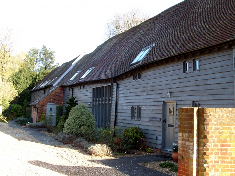
Entry Name: Barn 50 Metres South West of Parsonage Farmhouse
Listing Date: 29 May 1957
Last Amended: 7 February 1986
Grade: II
Source: Historic England
Source ID: 1093839
English Heritage Legacy ID: 140737
ID on this website: 101093839
Location: King's Somborne, Test Valley, Hampshire, SO20
County: Hampshire
District: Test Valley
Civil Parish: Kings Somborne
Built-Up Area: King's Somborne
Traditional County: Hampshire
Lieutenancy Area (Ceremonial County): Hampshire
Church of England Parish: Somborne with Ashley St Peter and St Paul
Church of England Diocese: Winchester
Tagged with: Barn
KINGS SOMBORNE CHURCH ROAD SU 361 14/12 Barn 5Om SW of Paraonage 29/5/57 Farmhouse (Formerly listed as Barn at GV Parsonage Farm) II Barn. C17 and C18. Timber-frame weatherboarded with corrugated iron roof. End onto road of 2 buildings, C17 7 bay barn at road end, C18 4-bay aisled barn at far end. C17 barn has double doors in centre bay, C18 barn has on far side hip-roofed midstray porch and roof half-hipped at far end. Inside C17 barn has queen post roof with angled queen posts and curved braces from posts to wallplates and tiebeams. C18 part has tall-posted queen post roof with straight braces and some windbraces.
Listing NGR: SP3411132681
External links are from the relevant listing authority and, where applicable, Wikidata. Wikidata IDs may be related buildings as well as this specific building. If you want to add or update a link, you will need to do so by editing the Wikidata entry.


Other nearby listed buildings