Approximate Location Map
Large Map »
Latitude: 50.9955 / 50°59'43"N
Longitude: -1.0322 / 1°1'56"W
OS Eastings: 468011
OS Northings: 122235
OS Grid: SU680222
Mapcode National: GBR B9V.HTY
Mapcode Global: FRA 86QH.3P5
Plus Code: 9C2WXXW9+64
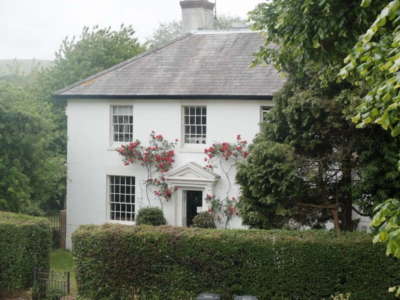
Entry Name: The White House
Listing Date: 16 March 1954
Grade: II
Source: Historic England
Source ID: 1094587
English Heritage Legacy ID: 142858
ID on this website: 101094587
Location: East Meon, East Hampshire, GU32
County: Hampshire
District: East Hampshire
Civil Parish: East Meon
Built-Up Area: East Meon
Traditional County: Hampshire
Lieutenancy Area (Ceremonial County): Hampshire
Church of England Parish: East Meon All Saints
Church of England Diocese: Portsmouth
Tagged with: House
6822 EAST MEON CHURCH STREET, West side
12/6 The White House
16.3.54
GV II
House. Early C19. Flint walls with brick dressings, stuccoed front; plinth,
stone cills. Hipped slate roof. Symmetrical north-east front of two storeys,
three windows. Sashes in reveals, 16 above 25 panes. Doorway of simple mouldings
with pediment, brackets, plain architrave and six-panelled (two top glazed) door.
External links are from the relevant listing authority and, where applicable, Wikidata. Wikidata IDs may be related buildings as well as this specific building. If you want to add or update a link, you will need to do so by editing the Wikidata entry.


Other nearby listed buildings
