Latitude: 50.9611 / 50°57'40"N
Longitude: -1.838 / 1°50'16"W
OS Eastings: 411476
OS Northings: 117980
OS Grid: SU114179
Mapcode National: GBR 416.Q4V
Mapcode Global: FRA 761K.MT3
Plus Code: 9C2WX566+FR
Entry Name: The Priory
Listing Date: 30 September 1964
Last Amended: 13 February 1987
Grade: II
Source: Historic England
Source ID: 1094810
English Heritage Legacy ID: 144123
ID on this website: 101094810
Location: Rockbourne, New Forest, Hampshire, SP6
County: Hampshire
District: New Forest
Civil Parish: Rockbourne
Built-Up Area: Rockbourne
Traditional County: Hampshire
Lieutenancy Area (Ceremonial County): Hampshire
Church of England Parish: Rockbourne St Andrew
Church of England Diocese: Salisbury
Tagged with: Priory
ROCKBOURNE (west side) SU 11 NW 5/42 The Priory 30.9.64 (Formerly listed as Priory GV Farm) II
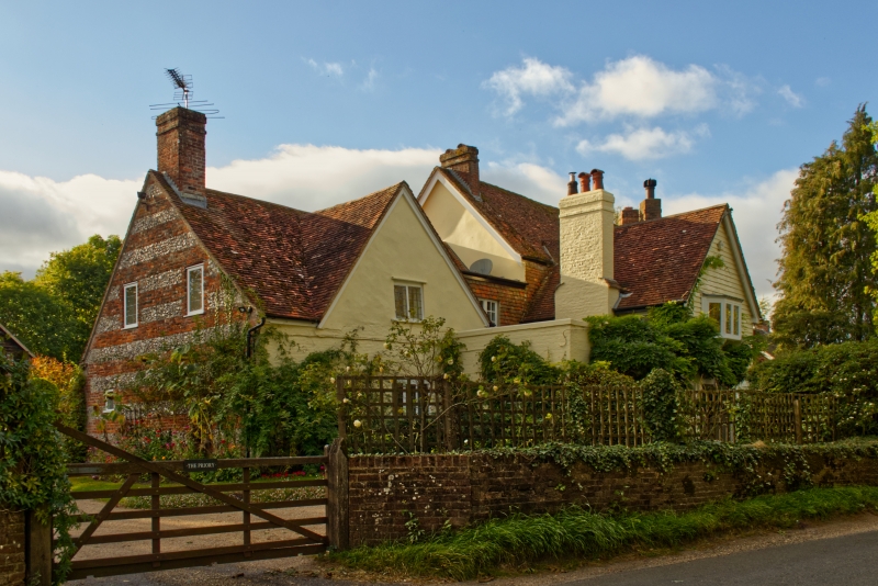
House. Possibly C16 or C17, remodelled C18, C19 and C20. Painted brick and rendered older part, plain tile roof, part weatherboarded. Plan of 1 1/2 storey T-shaped building with wing projecting forward in centre; to RH C18 2 storey, 3 bay altered C19 and C20 with centre projecting square- plan staircase wing and to LH bay projecting weatherboarded porch wing. Front has to C18 part in LH bay open ground floor with door and windows under, and oriel window. Central staircase bay has tall window. RH bay has C19 triple pointed windows and 1st floor bay. External stack at RH end with C19 diamond shafts. Stack at LH end and on side of LH wing. To LH C20 infill to RH side of centre wing 2-light casements, one in gable. Stack at LH end.
Listing NGR: SU1147617980
External links are from the relevant listing authority and, where applicable, Wikidata. Wikidata IDs may be related buildings as well as this specific building. If you want to add or update a link, you will need to do so by editing the Wikidata entry.


Other nearby listed buildings