Approximate Location Map
Large Map »
Latitude: 50.9561 / 50°57'22"N
Longitude: -1.77 / 1°46'11"W
OS Eastings: 416253
OS Northings: 117438
OS Grid: SU162174
Mapcode National: GBR 52M.WX7
Mapcode Global: FRA 765L.48J
Plus Code: 9C2WX64J+F2
Entry Name: Breamore Bridge
Listing Date: 13 February 1987
Grade: II
Source: Historic England
Source ID: 1094929
English Heritage Legacy ID: 143824
ID on this website: 101094929
Location: Woodgreen, New Forest, Hampshire, SP6
County: Hampshire
District: New Forest
Civil Parish: Breamore
Traditional County: Hampshire
Lieutenancy Area (Ceremonial County): Hampshire
Church of England Parish: Breamore St Mary
Church of England Diocese: Winchester
Tagged with: Bridge
SU 11 NE BREAMORE
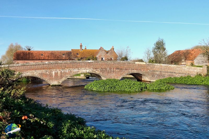
6/81 Breamore Bridge
GV II
Road bridge over the River Avon. 1867. Brick structure of three spans
with segmented arches. Brick parapet with stone cappings.
Listing NGR: SU1527218819
External links are from the relevant listing authority and, where applicable, Wikidata. Wikidata IDs may be related buildings as well as this specific building. If you want to add or update a link, you will need to do so by editing the Wikidata entry.


Other nearby listed buildings
