Approximate Location Map
Large Map »
Latitude: 51.3886 / 51°23'18"N
Longitude: 0.4037 / 0°24'13"E
OS Eastings: 567343
OS Northings: 168249
OS Grid: TQ673682
Mapcode National: GBR NN6.T1W
Mapcode Global: VHJLR.YC8B
Plus Code: 9F329CQ3+CF
Entry Name: Cobhambury House
Listing Date: 26 July 1983
Grade: II
Source: Historic England
Source ID: 1095056
English Heritage Legacy ID: 356727
ID on this website: 101095056
Location: Cobham, Gravesham, Kent, DA12
County: Kent
District: Gravesham
Civil Parish: Cobham
Built-Up Area: Cobham
Traditional County: Kent
Lieutenancy Area (Ceremonial County): Kent
Church of England Parish: Cobham St Mary Magdalene
Church of England Diocese: Rochester
Tagged with: House
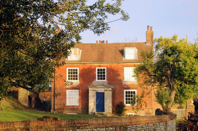
TQ 66 NE COBHAM COBHAMBURY ROAD
5/2
Cobhambury House
II
C17. Originally timber-framed with central brick stack, now brick encased and
rendered. Casement windows. West front brick faced dated 1817. Three sash windows
with glazing bars. Bath stone central porch with pediment added mid C19.
Single-storey addition to south (C20).
Listing NGR: TQ6734368249
External links are from the relevant listing authority and, where applicable, Wikidata. Wikidata IDs may be related buildings as well as this specific building. If you want to add or update a link, you will need to do so by editing the Wikidata entry.


Other nearby listed buildings
