Approximate Location Map
Large Map »
Latitude: 51.3967 / 51°23'48"N
Longitude: 0.3849 / 0°23'5"E
OS Eastings: 566007
OS Northings: 169107
OS Grid: TQ660691
Mapcode National: GBR NN5.85D
Mapcode Global: VHJLR.M5B3
Plus Code: 9F3299WM+MX
Entry Name: Jeskyns Court Granary
Listing Date: 26 July 1983
Grade: II
Source: Historic England
Source ID: 1095061
English Heritage Legacy ID: 356733
ID on this website: 101095061
Location: Henhurst, Gravesham, Kent, DA12
County: Kent
District: Gravesham
Civil Parish: Cobham
Traditional County: Kent
Lieutenancy Area (Ceremonial County): Kent
Church of England Parish: Cobham St Mary Magdalene
Church of England Diocese: Rochester
Tagged with: Building
TQ 66 NE COBHAM JESKYNS ROAD
5/7 (north side)
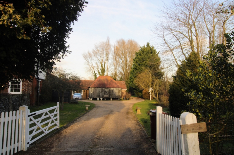
Jeskyns Court Granary
II
C18 timber granary on 9 stone staddles. Hipped tiled roof.
Listing NGR: TQ6598169103
External links are from the relevant listing authority and, where applicable, Wikidata. Wikidata IDs may be related buildings as well as this specific building. If you want to add or update a link, you will need to do so by editing the Wikidata entry.


Other nearby listed buildings
