Latitude: 51.0902 / 51°5'24"N
Longitude: -1.1624 / 1°9'44"W
OS Eastings: 458758
OS Northings: 132656
OS Grid: SU587326
Mapcode National: GBR 976.DYL
Mapcode Global: FRA 86G7.LYW
Plus Code: 9C3W3RRQ+32
Entry Name: Post Office
Listing Date: 16 November 1983
Grade: II
Source: Historic England
Source ID: 1095201
English Heritage Legacy ID: 145144
ID on this website: 101095201
Location: New Alresford, Winchester, Hampshire, SO24
County: Hampshire
District: Winchester
Civil Parish: New Alresford
Built-Up Area: New Alresford
Traditional County: Hampshire
Lieutenancy Area (Ceremonial County): Hampshire
Church of England Parish: New Alresford St John the Baptist
Church of England Diocese: Winchester
Tagged with: Post office
SU 5832 NEW ALRESFORD WEST STREET
13/98 No 17 (Post Office) GV II
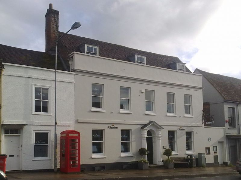
House, now post office. C18. Stucco, with a tile roof. A symmetrical front (north) of 2 storeys and attic, 5 windows. Parapet with coping stone and moulded cornice, moulded 1st floor band, stone cills, plinth. Victorian sashes, sashes to 3 C20 flat-roofed dormers. Doric doorcase, with open pediment, broken cornices above ¾ columns (plain, fluted necking), panelled reveals, arched opening with radiating fanlight, 6-panelled door, on stone steps. Tile roof with lead hopper heads and downpipes.
Listing NGR: SU5875732655
External links are from the relevant listing authority and, where applicable, Wikidata. Wikidata IDs may be related buildings as well as this specific building. If you want to add or update a link, you will need to do so by editing the Wikidata entry.


Other nearby listed buildings