Approximate Location Map
Large Map »
Latitude: 50.9 / 50°53'59"N
Longitude: -1.183 / 1°10'58"W
OS Eastings: 457551
OS Northings: 111483
OS Grid: SU575114
Mapcode National: GBR 99H.FRN
Mapcode Global: FRA 86DQ.JYG
Plus Code: 9C2WVRX8+XR
Entry Name: Table Tomb 30 Metres North of Church
Listing Date: 1 September 1987
Grade: II
Source: Historic England
Source ID: 1095611
English Heritage Legacy ID: 146277
ID on this website: 101095611
Location: St Nicholas's Church, Wickham, Winchester, Hampshire, PO17
County: Hampshire
District: Winchester
Civil Parish: Wickham
Built-Up Area: Wickham
Traditional County: Hampshire
Lieutenancy Area (Ceremonial County): Hampshire
Church of England Parish: Wickham
Church of England Diocese: Portsmouth
Tagged with: Building
WICKHAM SOUTHWICK ROAD
SU 5711
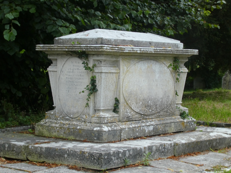
10/53 Table tomb 30 metres north
of church
II
Table tomb. 1807. Stone rectangular tomb with moulded cap, corner tapered and
reeded balusters with moulded caps and bases, moulded base. Inscription refers
to Sir John Miller, 1807.
Listing NGR: SU5799411303
External links are from the relevant listing authority and, where applicable, Wikidata. Wikidata IDs may be related buildings as well as this specific building. If you want to add or update a link, you will need to do so by editing the Wikidata entry.


Other nearby listed buildings
