Latitude: 51.046 / 51°2'45"N
Longitude: -1.0698 / 1°4'11"W
OS Eastings: 465304
OS Northings: 127812
OS Grid: SU653278
Mapcode National: GBR B97.6CV
Mapcode Global: FRA 86NC.11P
Plus Code: 9C3W2WWJ+93
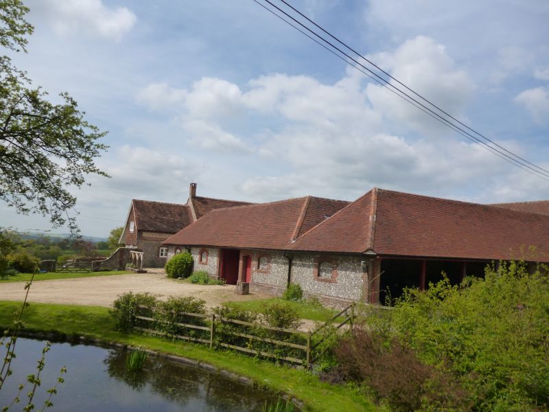
Entry Name: Farm Buildings 10 Metres East of Punsholt Farmhouse
Listing Date: 24 September 1987
Grade: II
Source: Historic England
Source ID: 1096182
English Heritage Legacy ID: 146676
ID on this website: 101096182
Location: Winchester, Hampshire, SO24
County: Hampshire
District: Winchester
Town: Winchester
Civil Parish: West Meon
Traditional County: Hampshire
Lieutenancy Area (Ceremonial County): Hampshire
Church of England Parish: West Meon St John the Evangelist
Church of England Diocese: Portsmouth
Tagged with: Agricultural structure
SU 62 NE WEST MEON WOODLANDS 2/2 Farm buildings 10 metres east of Punsholt Farmhouse GV II U-shaped range. Mid C19. Walls of coarse unknapped flintwork with brick plinth band, triangular quoins, flat pointed arches. Hipped tile roof. The buildings are on three sides of a courtyard, in front of the house, with fairly-regular patterns of windows (some filled) and doorways. There are cartshed openings on the east elevation. The north range is higher (with a hayloft) and has a tall waggon entrance.
Listing NGR: SP6530827826
External links are from the relevant listing authority and, where applicable, Wikidata. Wikidata IDs may be related buildings as well as this specific building. If you want to add or update a link, you will need to do so by editing the Wikidata entry.


Other nearby listed buildings