Latitude: 51.3793 / 51°22'45"N
Longitude: 0.3748 / 0°22'29"E
OS Eastings: 565365
OS Northings: 167150
OS Grid: TQ653671
Mapcode National: GBR NNB.KJW
Mapcode Global: VHJLR.FLZG
Plus Code: 9F3299HF+PW
Entry Name: 5 and 6, Camer Street
Listing Date: 26 July 1983
Grade: II
Source: Historic England
Source ID: 1096344
English Heritage Legacy ID: 356794
ID on this website: 101096344
Location: Sole Street, Gravesham, Kent, DA13
County: Kent
District: Gravesham
Civil Parish: Meopham
Traditional County: Kent
Lieutenancy Area (Ceremonial County): Kent
Church of England Parish: Meopham St John the Baptist
Church of England Diocese: Rochester
Tagged with: Building
TQ 66 NE MEOPHAM CAMER STREET
5/65
Nos 5 and 6
GV
II
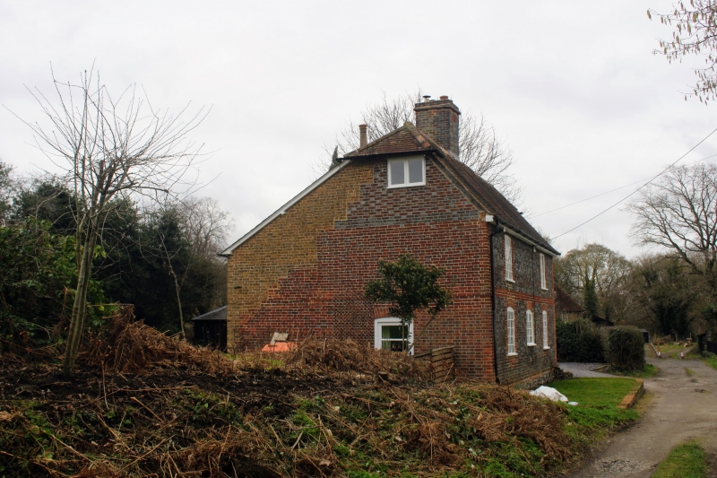
C18, now one dwelling. Timber-framed and faced in red and grey brick with central
chimney stack dated 1739. Half-hipped tiled roof. Cast iron casement windows with
glazing bars. C19 rear addition in yellow stock brick.
Listing NGR: TQ6536767153
External links are from the relevant listing authority and, where applicable, Wikidata. Wikidata IDs may be related buildings as well as this specific building. If you want to add or update a link, you will need to do so by editing the Wikidata entry.


Other nearby listed buildings