Latitude: 52.6056 / 52°36'20"N
Longitude: 1.7264 / 1°43'35"E
OS Eastings: 652410
OS Northings: 307389
OS Grid: TG524073
Mapcode National: GBR YQY.R91
Mapcode Global: WHNVZ.HRBV
Plus Code: 9F43JP4G+6H
Entry Name: Ship Inn
Listing Date: 5 August 1974
Grade: II
Source: Historic England
Source ID: 1096834
English Heritage Legacy ID: 468472
Also known as: Ship Inn, Great Yarmouth
ID on this website: 101096834
Location: Great Yarmouth, Norfolk, NR30
County: Norfolk
District: Great Yarmouth
Electoral Ward/Division: Nelson
Parish: Non Civil Parish
Built-Up Area: Great Yarmouth
Traditional County: Norfolk
Lieutenancy Area (Ceremonial County): Norfolk
Church of England Parish: Great Yarmouth
Church of England Diocese: Norwich
GREAT YARMOUTH
TG5207SW GREYFRIAR'S WAY 839-1/15/38 (North East side) 05/08/74 No.4 Ship Inn
GV II
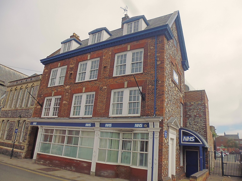
Formerly known as: No.4 Ship Inn MIDDLEGATE STREET. House. Late C17, remodelled late C19 as public house, altered mid C20. Brick and flint, entirely brick to south facade. Slate roof to front, pantiled to remainder. EXTERIOR: 3 storeys and attic plus a basement. 3-window range. Late C19 plate-glass public house facade with a canted doorway at the left (north) corner: timber pilasters support block entablatures and a dentil cornice. First floor lit through 3 paired 6/6 horned sashes within rebuilt surrounds and gauged skewback arches. Remains of 3 C17 pediments visible above. 3 similar second-floor sashes. Gabled roof with internal gable-end stack to north and ridge stack right of centre. South-east return rebuilt in brick and flint 1948 following bomb damage: timber doorway under a pediment; two 6/6 sashes set to right and a 2-light mullioned attic window re-used. Prominent modillion bargeboards. North-west return with 3 blocked C17 windows and a 2-light ovolo-moulded attic window. Rear elevation has a 2-storeyed pantiled cross-wing extending to rear to the right of a square stair turret under a hipped slate roof. Left of the turret, and partly obscured by it, is remains of a C17 window pediment. The cross-wing has a partly external east stack. INTERIOR: cellars have some C17 brick. Main bar opened out into one room. South end with a chamfered C17 bridging beam. North end with 2 sunk-quadrant late C17 bridging beams with barred tongue stops. Late C19 staircase with bulbous turned balusters and barleysugar balusters. Inserted corridor to front range. Several sunk-quadrant moulded bridging beams. Main roof with mid C20 concrete wall-plate, principals, collars and butt purlins, all rebuilt mid C20 re-using some C18 timbers.
Listing NGR: TG5239807423
External links are from the relevant listing authority and, where applicable, Wikidata. Wikidata IDs may be related buildings as well as this specific building. If you want to add or update a link, you will need to do so by editing the Wikidata entry.


Other nearby listed buildings