Latitude: 54.4047 / 54°24'17"N
Longitude: -1.7436 / 1°44'36"W
OS Eastings: 416742
OS Northings: 501060
OS Grid: NZ167010
Mapcode National: GBR JK8H.9S
Mapcode Global: WHC6D.5KZ3
Plus Code: 9C6WC734+VH
Entry Name: 28, Victoria Road
Listing Date: 15 October 1973
Grade: II
Source: Historic England
Source ID: 1096974
English Heritage Legacy ID: 439743
ID on this website: 101096974
Location: Friars' Closes, North Yorkshire, DL10
County: North Yorkshire
District: Richmondshire
Civil Parish: Richmond
Built-Up Area: Richmond
Traditional County: Yorkshire
Lieutenancy Area (Ceremonial County): North Yorkshire
Church of England Parish: Richmond with Holy Trinity with Hudswell
Church of England Diocese: Leeds
Tagged with: Building
1. VICTORIA ROAD 1549 (North Side) No 28 NZ 1601 SE 2/427
II GV
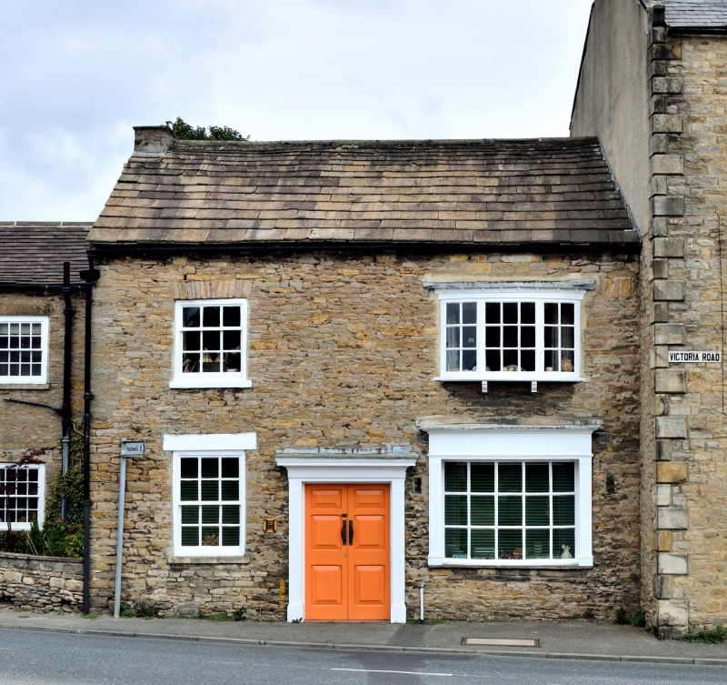
2. Early C19. Two storeys in coursed rubble. Roof of stone slates with one stack. Two windows, no glazing bars, Ground floor has small bay window as shop front and half-glazed double doors in wood pilastered architrave with frieze and cornice.
Nos 10 to 28 (even) form a group
Listing NGR: NZ1674201060
External links are from the relevant listing authority and, where applicable, Wikidata. Wikidata IDs may be related buildings as well as this specific building. If you want to add or update a link, you will need to do so by editing the Wikidata entry.


Other nearby listed buildings