Approximate Location Map
Large Map »
Latitude: 51.2774 / 51°16'38"N
Longitude: 1.0867 / 1°5'12"E
OS Eastings: 615376
OS Northings: 157670
OS Grid: TR153576
Mapcode National: GBR TY2.ZGL
Mapcode Global: VHLGM.S5B1
Plus Code: 9F3373GP+XM
Entry Name: 9, Longport
Listing Date: 3 December 1949
Grade: II
Source: Historic England
Source ID: 1097016
English Heritage Legacy ID: 439685
ID on this website: 101097016
Location: Canterbury, Kent, CT1
County: Kent
District: Canterbury
Electoral Ward/Division: Barton
Parish: Non Civil Parish
Built-Up Area: Canterbury
Traditional County: Kent
Lieutenancy Area (Ceremonial County): Kent
Tagged with: Building
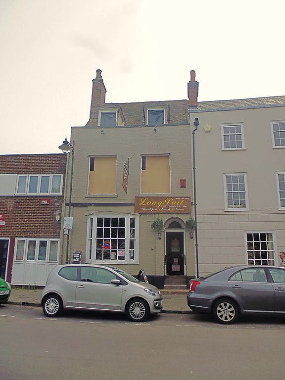
1.
944 LONGPORT
(South Side)
No 9
TR 1557 NW 5/157
3.12.49.
II GV
2.
Cl8. 2 storeys and dormers red brick. The ground floor is now painted. 3
sashes with glazing bars intact, Tiled roof with stone coping. Stringcourse.
Ground floor has 3 light bay. Plinth.
Nos 6A to 9 (consec) form a group.
Listing NGR: TR1537657643
External links are from the relevant listing authority and, where applicable, Wikidata. Wikidata IDs may be related buildings as well as this specific building. If you want to add or update a link, you will need to do so by editing the Wikidata entry.


Other nearby listed buildings
