Approximate Location Map
Large Map »
Latitude: 50.606 / 50°36'21"N
Longitude: -3.759 / 3°45'32"W
OS Eastings: 275622
OS Northings: 79951
OS Grid: SX756799
Mapcode National: GBR QH.W616
Mapcode Global: FRA 370G.PC6
Plus Code: 9C2RJ64R+99
Entry Name: Beckaford Bridge
Listing Date: 4 February 1987
Grade: II
Source: Historic England
Source ID: 1097243
English Heritage Legacy ID: 84937
ID on this website: 101097243
Location: Teignbridge, Devon, TQ13
County: Devon
District: Teignbridge
Civil Parish: Manaton
Traditional County: Devon
Lieutenancy Area (Ceremonial County): Devon
Church of England Parish: Manaton St Winifred
Church of England Diocese: Exeter
Tagged with: Bridge
MANATON
SX 77 NE
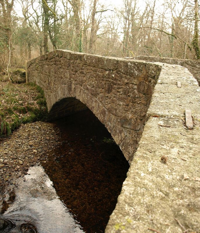
7/2 Beckaford Bridge
-
- II
Road bridge over Becka brook. Circa early C19. Granite rubble with dressed stone
arch and roughly squared coping stones. Single wide span segmental arch with
rough projecting keystone on up-stream side. Parapets raised up to crank at centre
and swept out to wide abuttments at north-west end.
Listing NGR: SX7562279951
External links are from the relevant listing authority and, where applicable, Wikidata. Wikidata IDs may be related buildings as well as this specific building. If you want to add or update a link, you will need to do so by editing the Wikidata entry.


Other nearby listed buildings
