Approximate Location Map
Large Map »
Latitude: 50.6766 / 50°40'35"N
Longitude: -3.2436 / 3°14'36"W
OS Eastings: 312229
OS Northings: 87066
OS Grid: SY122870
Mapcode National: GBR P8.C5P1
Mapcode Global: FRA 4739.05Y
Plus Code: 9C2RMQG4+JH
Entry Name: Garden Wall of Rock Cottage Along Peak Hill Road
Listing Date: 12 November 1973
Grade: II
Source: Historic England
Source ID: 1097949
English Heritage Legacy ID: 87268
ID on this website: 101097949
Location: Western Town, East Devon, EX10
County: Devon
District: East Devon
Civil Parish: Sidmouth
Built-Up Area: Sidmouth
Traditional County: Devon
Lieutenancy Area (Ceremonial County): Devon
Church of England Parish: Sidmouth
Church of England Diocese: Exeter
Tagged with: Wall
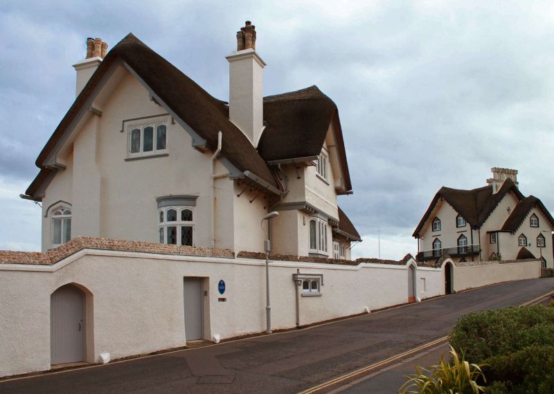
CLIFTON PLACE
1.
1633
Garden Wall of Rock
Cottage along Peak
Hill Road
SY 1287 1/47A
II GV
2.
Rendered wall with flint coping and Tudor arched doorways, continued as
boundary wall of The Beacon Clifton Place
All the listed buildings in Clifton Place form a group.
Listing NGR: SY1222987066
External links are from the relevant listing authority and, where applicable, Wikidata. Wikidata IDs may be related buildings as well as this specific building. If you want to add or update a link, you will need to do so by editing the Wikidata entry.


Other nearby listed buildings
