Approximate Location Map
Large Map »
Latitude: 50.8082 / 50°48'29"N
Longitude: -3.0442 / 3°2'39"W
OS Eastings: 326519
OS Northings: 101477
OS Grid: ST265014
Mapcode National: GBR M3.YJKN
Mapcode Global: FRA 46HY.RV6
Plus Code: 9C2RRX54+78
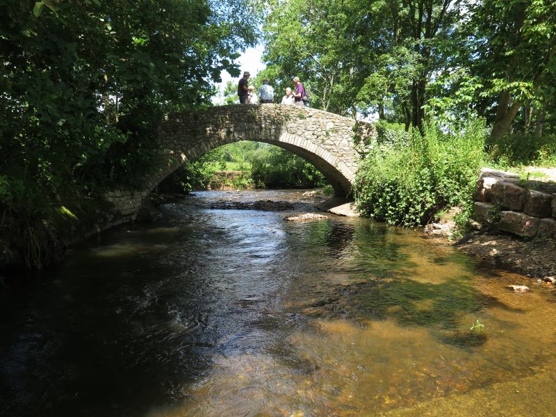
Entry Name: Beckford Bridge
Listing Date: 8 May 1967
Grade: II
Source: Historic England
Source ID: 1098481
English Heritage Legacy ID: 88057
ID on this website: 101098481
Location: East Devon, EX13
County: Devon
District: East Devon
Civil Parish: Membury
Traditional County: Devon
Lieutenancy Area (Ceremonial County): Devon
Church of England Parish: Membury
Church of England Diocese: Exeter
ST 20 SE MEMBURY DALWOOD LANE
5/376
8.5.67 Beckford Bridge
II
Footbridge. C18/19 stone rubble packhorse bridge over River Yarty. Single span
with wide round arch with small voussoirs. Plain parapet with rubble coping.
Listing NGR: ST2651901477
External links are from the relevant listing authority and, where applicable, Wikidata. Wikidata IDs may be related buildings as well as this specific building. If you want to add or update a link, you will need to do so by editing the Wikidata entry.


Other nearby listed buildings
