Approximate Location Map
Large Map »
Latitude: 54.2009 / 54°12'3"N
Longitude: -2.9523 / 2°57'8"W
OS Eastings: 337976
OS Northings: 478770
OS Grid: SD379787
Mapcode National: GBR 7MTV.MV
Mapcode Global: WH83C.MNCW
Plus Code: 9C6V622X+93
Entry Name: Maychell Monument Approximately 27.5 Metres South of Priory Church
Listing Date: 15 February 1989
Grade: II
Source: Historic England
Source ID: 1099106
English Heritage Legacy ID: 76962
ID on this website: 101099106
Location: Priory Church of St Mary, Cartmel, Westmorland and Furness, Cumbria, LA11
County: Cumbria
District: South Lakeland
Civil Parish: Lower Allithwaite
Traditional County: Lancashire
Lieutenancy Area (Ceremonial County): Cumbria
Church of England Parish: Cartmel St Mary and St Michael
Church of England Diocese: Carlisle
Tagged with: Monument
LOWER ALLITHWAITE CARTMEL
SD 3678
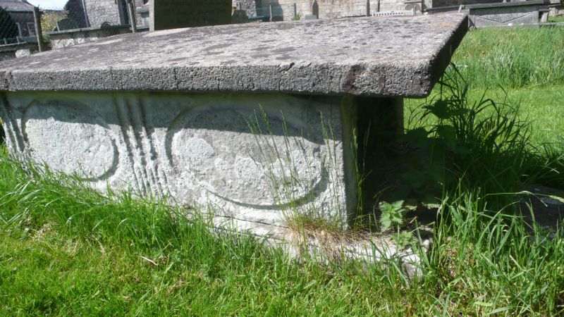
8/49 Maychell Monument
approx 27.5m south of
Priory Church
G.V. II
Table tomb. 1791. Ashlar. Slab has hollow chamfered edges and 4 short
balusters. Records James Maychell.
Listing NGR: SD3797678770
External links are from the relevant listing authority and, where applicable, Wikidata. Wikidata IDs may be related buildings as well as this specific building. If you want to add or update a link, you will need to do so by editing the Wikidata entry.


Other nearby listed buildings
