Latitude: 52.39 / 52°23'24"N
Longitude: -2.2511 / 2°15'3"W
OS Eastings: 383010
OS Northings: 276917
OS Grid: SO830769
Mapcode National: GBR 1CS.1PM
Mapcode Global: VH91T.X6T4
Plus Code: 9C4V9PRX+2H
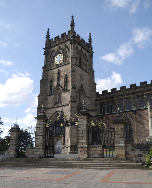
Entry Name: Gates, Gate Piers and Railings to South of Church of St Mary and All Saints
Listing Date: 17 January 1980
Grade: II
Source: Historic England
Source ID: 1100051
English Heritage Legacy ID: 156456
ID on this website: 101100051
Location: St Mary and All Saints Church, Kidderminster, Wyre Forest, Worcestershire, DY10
County: Worcestershire
District: Wyre Forest
Civil Parish: Kidderminster
Built-Up Area: Kidderminster
Traditional County: Worcestershire
Lieutenancy Area (Ceremonial County): Worcestershire
Church of England Parish: Kidderminster Ismere
Church of England Diocese: Worcester
Tagged with: Gate
THE RINGWAY 1. 5250 (north-east side) Gates, gate piers and railings to south of Church of St Mary and All Saints SO 8276 SO 8376 1/16A II GV 2. Modern copies of C18 wrought iron gates. Four rusticated gate piers rebuilt on older stone plinth walls with iron crests. Outer piers have copy foot gates and iron standard railings on wall. Centre carriage gates with elaborate overthrow, 6 steps. Included as an interesting reproduction of the original on older stonework.
Listing NGR: SO8301076916
External links are from the relevant listing authority and, where applicable, Wikidata. Wikidata IDs may be related buildings as well as this specific building. If you want to add or update a link, you will need to do so by editing the Wikidata entry.


Other nearby listed buildings