Latitude: 51.2835 / 51°17'0"N
Longitude: 0.4437 / 0°26'37"E
OS Eastings: 570518
OS Northings: 156659
OS Grid: TQ705566
Mapcode National: GBR NPL.K0F
Mapcode Global: VHJM5.MZYX
Plus Code: 9F327CMV+CF
Entry Name: Barn 80 Yards to the East of Paris Farmhouse
Listing Date: 25 February 1987
Grade: II
Source: Historic England
Source ID: 1100295
English Heritage Legacy ID: 179362
ID on this website: 101100295
Location: East Malling, Tonbridge and Malling, Kent, ME19
County: Kent
District: Tonbridge and Malling
Civil Parish: East Malling and Larkfield
Built-Up Area: Ditton
Traditional County: Kent
Lieutenancy Area (Ceremonial County): Kent
Church of England Parish: East Malling St James
Church of England Diocese: Rochester
Tagged with: Barn
EAST MALLING AND LARKFIELD CP THE ROCKS ROAD TQ 7056 (north side) 15/187 Barn 80 yards to the - east of Paris Farmhouse
- II
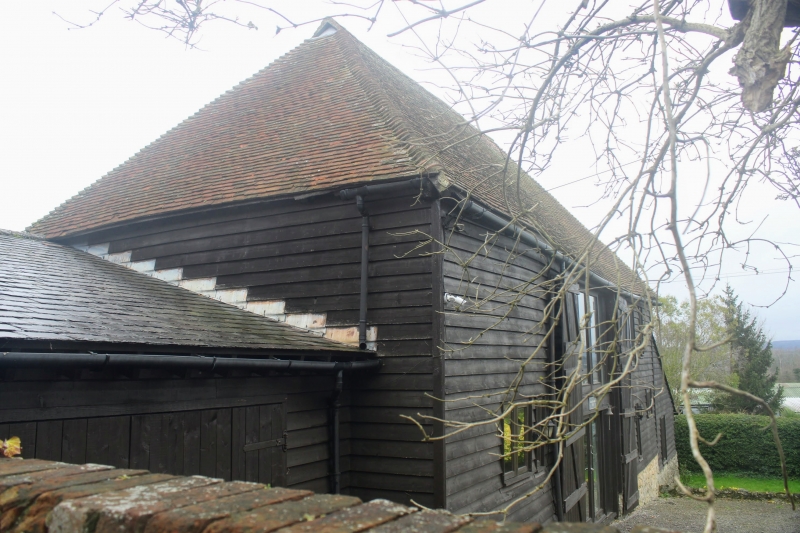
Barn. C17. Weather-boarded on wide random rubblestone plinth. Plain tiled roof. Wagon entrance to east, extension to rear and wagon shed lean-to to right. Fire bays with queen-post roof.
Listing NGR: TQ7051856659
External links are from the relevant listing authority and, where applicable, Wikidata. Wikidata IDs may be related buildings as well as this specific building. If you want to add or update a link, you will need to do so by editing the Wikidata entry.


Other nearby listed buildings