Latitude: 52.3274 / 52°19'38"N
Longitude: -2.0576 / 2°3'27"W
OS Eastings: 396171
OS Northings: 269919
OS Grid: SO961699
Mapcode National: GBR 2G4.2M0
Mapcode Global: VH9ZL.9R2Q
Plus Code: 9C4V8WGR+WX
Entry Name: Broom House
Listing Date: 28 April 1952
Grade: II
Source: Historic England
Source ID: 1100361
English Heritage Legacy ID: 155729
ID on this website: 101100361
Location: Stoney Hill, Bromsgrove, Worcestershire, B60
County: Worcestershire
District: Bromsgrove
Electoral Ward/Division: Bromsgrove Central
Parish: Non Civil Parish
Built-Up Area: Bromsgrove
Traditional County: Worcestershire
Lieutenancy Area (Ceremonial County): Worcestershire
Church of England Parish: Bromsgrove
Church of England Diocese: Worcester
Tagged with: House
1.
909
SO 96 NE
6/86
28.4.52
OLD STATION ROAD,
ASHTON FIELDS
No 80 (Broom House)
II
GV
2.
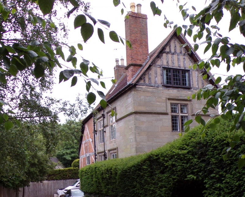
Probably early C17. 2 storeys and attic. 2 windows. Ashlar sandstone.
End gable heads are of close set studding. Continuous moulded string course
which breaks upward to form hood moulds aver transomed and mullioned stone
windows. Metal casements. Leaded lights. Abutting to west side is a lower
2 storey wing of square timber framing partly rebuilt in plain C18 brickwork.
Extension to the south of simple mid C19 brickwork. Roof is mainly old
tiles.
No 80 and Farm buildings to west form a group.
Listing NGR: SO9617169919
External links are from the relevant listing authority and, where applicable, Wikidata. Wikidata IDs may be related buildings as well as this specific building. If you want to add or update a link, you will need to do so by editing the Wikidata entry.


Other nearby listed buildings