Latitude: 52.3722 / 52°22'19"N
Longitude: -2.2041 / 2°12'14"W
OS Eastings: 386199
OS Northings: 274925
OS Grid: SO861749
Mapcode National: GBR 1D1.7KW
Mapcode Global: VH91V.RM4V
Plus Code: 9C4V9QCW+V9
Entry Name: Chest Tomb About 8 Metres South of Nave of Church of St Mary
Listing Date: 18 March 1987
Grade: II
Source: Historic England
Source ID: 1100665
English Heritage Legacy ID: 157107
ID on this website: 101100665
Location: St Mary's Church, Stone, Wyre Forest, Worcestershire, DY10
County: Worcestershire
District: Wyre Forest
Civil Parish: Stone
Traditional County: Worcestershire
Lieutenancy Area (Ceremonial County): Worcestershire
Church of England Parish: Kidderminster East
Church of England Diocese: Worcester
Tagged with: Chest tomb
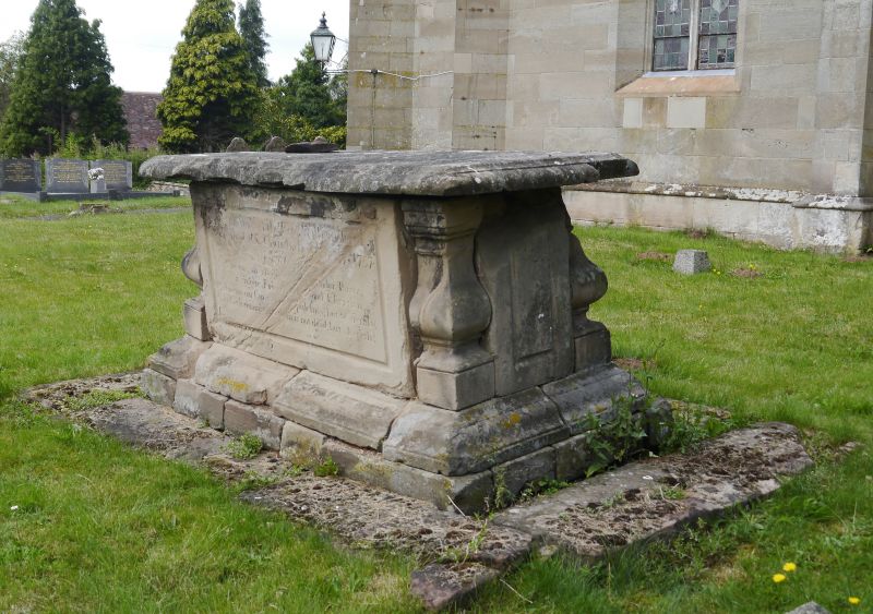
STONE CP STONE HILL (north side) SO 87 SE 10/117 Chest tomb about 8 metres south of nave of Church of St Mary GV II
Chest tomb. Died 1757. Sandstone ashlar. Flat top, moulded top, engaged balusters to corners, moulded plinth. Inscription (south): "Mary the wife of the Revd William Je ...s/ Vicar of this church died February 5th 1751/ Aged 6./ She was an affection[ate] ...nder parent/ a sincere friend and good Christian/ What means our care abo... ...pulchres;/ but to signify/ ...hat what is committed to them is not dead but sleepeth".
Listing NGR: SO8619974925
External links are from the relevant listing authority and, where applicable, Wikidata. Wikidata IDs may be related buildings as well as this specific building. If you want to add or update a link, you will need to do so by editing the Wikidata entry.


Other nearby listed buildings