Approximate Location Map
Large Map »
Latitude: 53.2454 / 53°14'43"N
Longitude: -1.6132 / 1°36'47"W
OS Eastings: 425906
OS Northings: 372113
OS Grid: SK259721
Mapcode National: GBR KZ5X.JB
Mapcode Global: WHCD2.6P1C
Plus Code: 9C5W69WP+5P
Entry Name: Barbrook Old Bridge
Listing Date: 4 October 1974
Grade: II
Source: Historic England
Source ID: 1101731
English Heritage Legacy ID: 81569
ID on this website: 101101731
Location: Nether End, Derbyshire Dales, Derbyshire, DE45
County: Derbyshire
District: Derbyshire Dales
Civil Parish: Baslow and Bubnell
Built-Up Area: Baslow
Traditional County: Derbyshire
Lieutenancy Area (Ceremonial County): Derbyshire
Church of England Parish: Baslow St Anne
Church of England Diocese: Derby
Tagged with: Bridge
PARISH OF BASLOW & BUBNELL BARBROOK LANE,
SK 27 SE
3/4 NETHER END
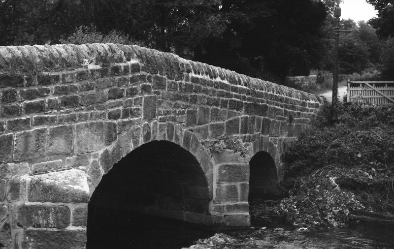
Barbrook Old Bridge
4.10.74
II
Road bridge. Late C18. Coursed squared gritstone. Three
almost round arches, divided by triangular cutwaters with
slanting tops. Bridge rises to centre. Plain parapet wall with
roughly rounded copings.
Listing NGR: SK2590672113
External links are from the relevant listing authority and, where applicable, Wikidata. Wikidata IDs may be related buildings as well as this specific building. If you want to add or update a link, you will need to do so by editing the Wikidata entry.


Other nearby listed buildings
