Approximate Location Map
Large Map »
Latitude: 51.9725 / 51°58'21"N
Longitude: -0.3311 / 0°19'52"W
OS Eastings: 514735
OS Northings: 231766
OS Grid: TL147317
Mapcode National: GBR H5M.73V
Mapcode Global: VHGNK.6PT7
Plus Code: 9C3XXMF9+2H
Entry Name: 20, High Street
Listing Date: 24 October 1988
Grade: II
Source: Historic England
Source ID: 1103193
English Heritage Legacy ID: 163174
ID on this website: 101103193
Location: Pirton, North Hertfordshire, SG5
County: Hertfordshire
District: North Hertfordshire
Civil Parish: Pirton
Built-Up Area: Pirton
Traditional County: Hertfordshire
Lieutenancy Area (Ceremonial County): Hertfordshire
Church of England Parish: Pirton
Church of England Diocese: St.Albans
Tagged with: Building Thatched cottage
PIRTON HIGH STREET
TL 1431 (South side)
7/164 No. 20
-
GV II
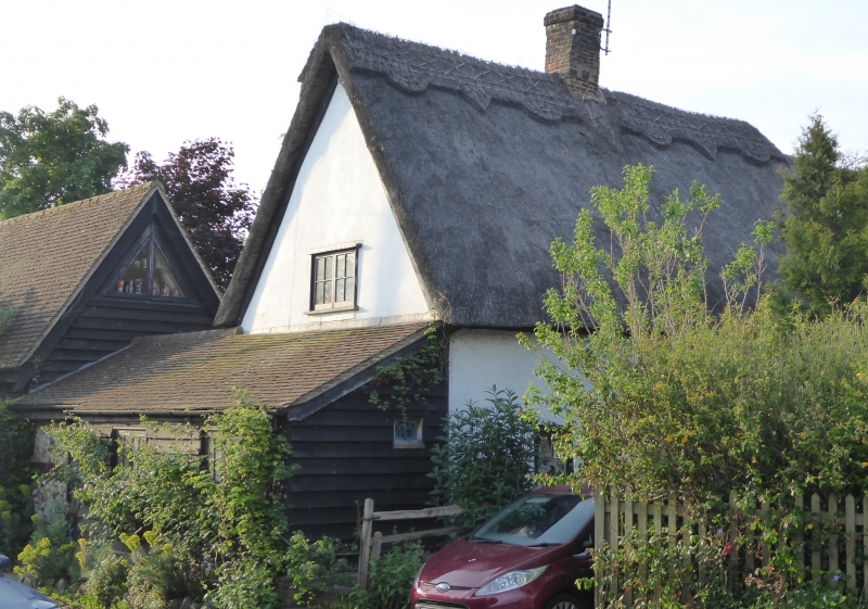
House. C17 or earlier. Timber frame, roughcast, with steep pitched
thatch roof. A small 1 1/2-storeys house with N gable on roadside, facing
E. A 2-cells plan with internal chimney rising in rear slope, and
entrance now at S end of front, and into lean-to extension at N end with
tiled roof. E front has 3 windows and 2 swept dormers at the eaves.
3-light flush casement windows. Plank door to N lean-to. 2 windows to
rear with indication of stair to rear of chimney. Projecting timber in
apex of N gable suggests that the roof may possibly be of cruck type.
Listing NGR: TL1473531766
External links are from the relevant listing authority and, where applicable, Wikidata. Wikidata IDs may be related buildings as well as this specific building. If you want to add or update a link, you will need to do so by editing the Wikidata entry.


Other nearby listed buildings
