Approximate Location Map
Large Map »
Latitude: 50.6813 / 50°40'52"N
Longitude: -3.4651 / 3°27'54"W
OS Eastings: 296589
OS Northings: 87875
OS Grid: SX965878
Mapcode National: GBR P2.JRRV
Mapcode Global: FRA 37M8.PW1
Plus Code: 9C2RMGJM+GX
Entry Name: King's Beam
Listing Date: 11 November 1952
Grade: II
Source: Historic England
Source ID: 1103959
English Heritage Legacy ID: 89074
ID on this website: 101103959
Location: Topsham, Exeter, Devon, EX3
County: Devon
District: Exeter
Electoral Ward/Division: Topsham
Parish: Non Civil Parish
Built-Up Area: Topsham
Traditional County: Devon
Lieutenancy Area (Ceremonial County): Devon
Church of England Parish: Topsham St Margaret
Church of England Diocese: Exeter
Tagged with: Weighing scale Architectural structure
FERRY ROAD
1.
1092
(South End)
TOPSHAM
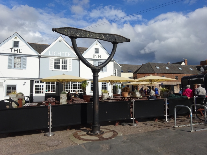
King's Beam
(Formerly listed in the rural
district of St Thomas)
SX 9688
9/821
11.11.52
II
2.
Early C19. Cast iron scales similar to the dated ones on Exeter Quay (qv).
Listing NGR: SX9658987875
External links are from the relevant listing authority and, where applicable, Wikidata. Wikidata IDs may be related buildings as well as this specific building. If you want to add or update a link, you will need to do so by editing the Wikidata entry.


Other nearby listed buildings
