Latitude: 50.7204 / 50°43'13"N
Longitude: -3.535 / 3°32'6"W
OS Eastings: 291736
OS Northings: 92324
OS Grid: SX917923
Mapcode National: GBR P0.Q4SX
Mapcode Global: FRA 37H5.LN2
Plus Code: 9C2RPFC7+5X
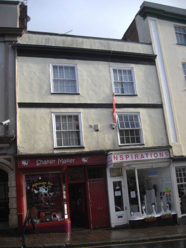
Entry Name: 122 and 123, Fore Street
Listing Date: 18 June 1974
Grade: II
Source: Historic England
Source ID: 1103964
English Heritage Legacy ID: 89091
ID on this website: 101103964
Location: Exeter, Devon, EX4
County: Devon
District: Exeter
Electoral Ward/Division: St David's
Parish: Non Civil Parish
Built-Up Area: Exeter
Traditional County: Devon
Lieutenancy Area (Ceremonial County): Devon
Church of England Parish: Exeter St Mary Steps
Church of England Diocese: Exeter
Tagged with: Building
FORE STREET 1. 1092 (South-east Side) Nos 122 and 123 SX 9192 SE 5/165A II GV 2. C18 front. Rendered bands at second floor and cornice levels. Three storeys, two windows to pair, sashes with glazing bars. C19 shop front. Parapet, roof not visible. Nos 118 to 125 (consec) and Devonport Inn form a group.
Listing NGR: SX9173692324
External links are from the relevant listing authority and, where applicable, Wikidata. Wikidata IDs may be related buildings as well as this specific building. If you want to add or update a link, you will need to do so by editing the Wikidata entry.


Other nearby listed buildings