Approximate Location Map
Large Map »
Latitude: 54.5118 / 54°30'42"N
Longitude: -1.3493 / 1°20'57"W
OS Eastings: 442226
OS Northings: 513141
OS Grid: NZ422131
Mapcode National: GBR MJ08.PD
Mapcode Global: WHD74.7VQJ
Plus Code: 9C6WGM62+P7
Entry Name: Stable Buildings to East of Village Farmhouse
Listing Date: 21 June 1985
Grade: II
Source: Historic England
Source ID: 1104881
English Heritage Legacy ID: 59233
ID on this website: 101104881
Location: Yarm, Stockton-on-Tees, North Yorkshire, TS16
County: Stockton-on-Tees
Civil Parish: Egglescliffe
Built-Up Area: Yarm
Traditional County: Durham
Lieutenancy Area (Ceremonial County): County Durham
Church of England Parish: Egglescliffe
Church of England Diocese: Durham
Tagged with: Stable
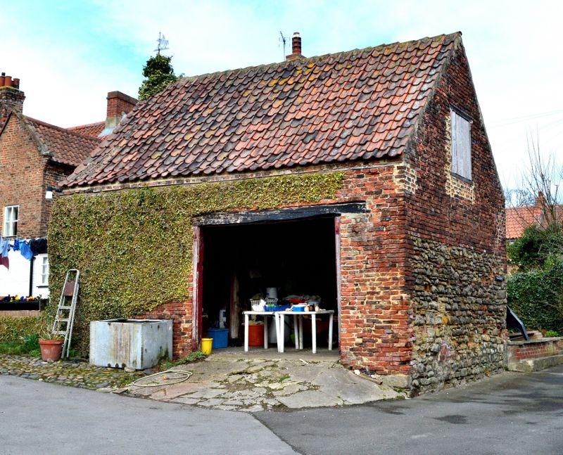
NZ 4213 EGGLESCLIFFE CHURCH ROAD
(South side)
34/471 Stable buildings to
east of Village Farmhouse
II
C18 building, part rubble part brick with pantiled roof. Original door beam.
Old wood stall and manger racks inside. Included for group value.
Listing NGR: NZ4222613141
External links are from the relevant listing authority and, where applicable, Wikidata. Wikidata IDs may be related buildings as well as this specific building. If you want to add or update a link, you will need to do so by editing the Wikidata entry.


Other nearby listed buildings
