Latitude: 52.3874 / 52°23'14"N
Longitude: -1.5218 / 1°31'18"W
OS Eastings: 432643
OS Northings: 276705
OS Grid: SP326767
Mapcode National: GBR HBW.P6
Mapcode Global: VHBX4.K8V4
Plus Code: 9C4W9FPH+X7
Entry Name: The Smithy
Listing Date: 24 June 1974
Grade: II
Source: Historic England
Source ID: 1104926
English Heritage Legacy ID: 218582
ID on this website: 101104926
Location: Stivichall, Coventry, West Midlands, CV3
County: Coventry
Electoral Ward/Division: Earlsdon
Parish: Non Civil Parish
Built-Up Area: Coventry
Traditional County: Warwickshire
Lieutenancy Area (Ceremonial County): West Midlands
Church of England Parish: Styvechale St James
Church of England Diocese: Coventry
Tagged with: Smithy
1.
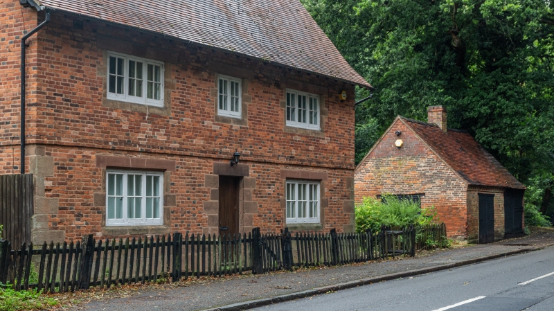
5105 STIVICHALL CROFT
(North Side)
----------------
The Smithy
SP 37 NW 17/369
II
2.
C18. Red brick, tiled roof. 1 storey, corbelled brick cornice. 2 wide 2 fold
doors. Shuttered side window.
Listing NGR: SP3264376705
External links are from the relevant listing authority and, where applicable, Wikidata. Wikidata IDs may be related buildings as well as this specific building. If you want to add or update a link, you will need to do so by editing the Wikidata entry.


Other nearby listed buildings