Latitude: 50.6097 / 50°36'34"N
Longitude: -4.0529 / 4°3'10"W
OS Eastings: 254840
OS Northings: 80898
OS Grid: SX548808
Mapcode National: GBR Q0.BW8W
Mapcode Global: FRA 27DG.8W3
Plus Code: 9C2QJW5W+VR
Entry Name: Baggator Farmhouse
Listing Date: 28 October 1987
Grade: II
Source: Historic England
Source ID: 1105395
English Heritage Legacy ID: 92803
ID on this website: 101105395
Location: West Devon, PL19
County: Devon
District: West Devon
Civil Parish: Peter Tavy
Traditional County: Devon
Lieutenancy Area (Ceremonial County): Devon
Tagged with: Farmhouse
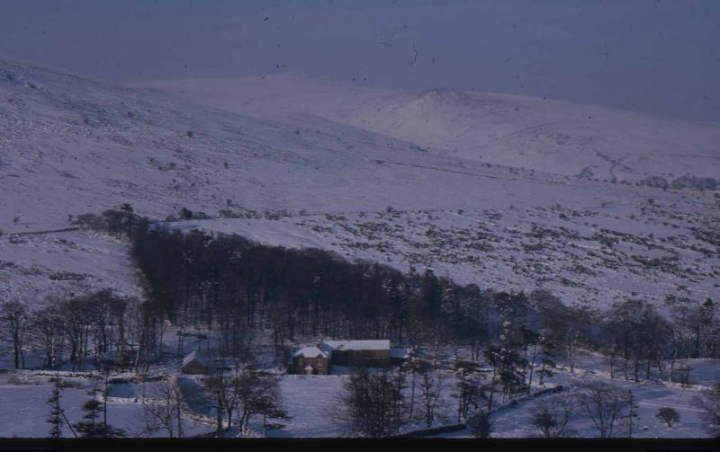
PETER TAVY
SX 58 SW
5/71 Baggator Farmhouse
- II
Farmhouse presently used as youth training centre. C17 with C19 addition and
alterations. Granite rubble walls. Gable ended slate and tarred slate roof to
older part, hipped slate to C19 part. Large rendered rubble axial stack to older
part. C19 range has 2 rendered stacks, one rear lateral and one at the right-hand
end.
Plan: At present L-shaped of larger older range with C19 addition at right-hand end
projecting to rear. Original plan of older range is unclear but it has a heated
room to the right and 3 rooms to the left which may originally have been a passage
and shippon. Addition at right end added probably in mid-late C19 with 2 room plan.
2 storeys. Asymmetrical 4 window front, the 2 right-hand windows are in the end
wall of the C19 block. All C20 2 and 3 light casements with small panes. C20 pland
door to right of centre with a blocked doorway to its left and the left-hand window
is in another blocked doorway. C19 block projects to rear from right-hand end with
2 window front. Projecting from the left end of the older range is a long 2 storey
circa mid C19 barn with 2 doorways towards the centre which have loading openings
above small windows to right and 3 slits to left of doors.
Interior inaccessible at time of survey and appears to have been considerably
modernised but may conceal original features.
This building occupies a remote position and has considerabe landscape value.
Listing NGR: SX5484080898
External links are from the relevant listing authority and, where applicable, Wikidata. Wikidata IDs may be related buildings as well as this specific building. If you want to add or update a link, you will need to do so by editing the Wikidata entry.


Other nearby listed buildings