Latitude: 51.1606 / 51°9'38"N
Longitude: 0.6653 / 0°39'55"E
OS Eastings: 586462
OS Northings: 143522
OS Grid: TQ864435
Mapcode National: GBR QV3.122
Mapcode Global: VHJN2.H324
Plus Code: 9F325M68+64
Entry Name: Watch House
Listing Date: 17 September 1952
Grade: II
Source: Historic England
Source ID: 1106234
English Heritage Legacy ID: 181175
ID on this website: 101106234
Location: Smarden Bell, Ashford, Kent, TN27
County: Kent
District: Ashford
Civil Parish: Smarden
Traditional County: Kent
Lieutenancy Area (Ceremonial County): Kent
Tagged with: House
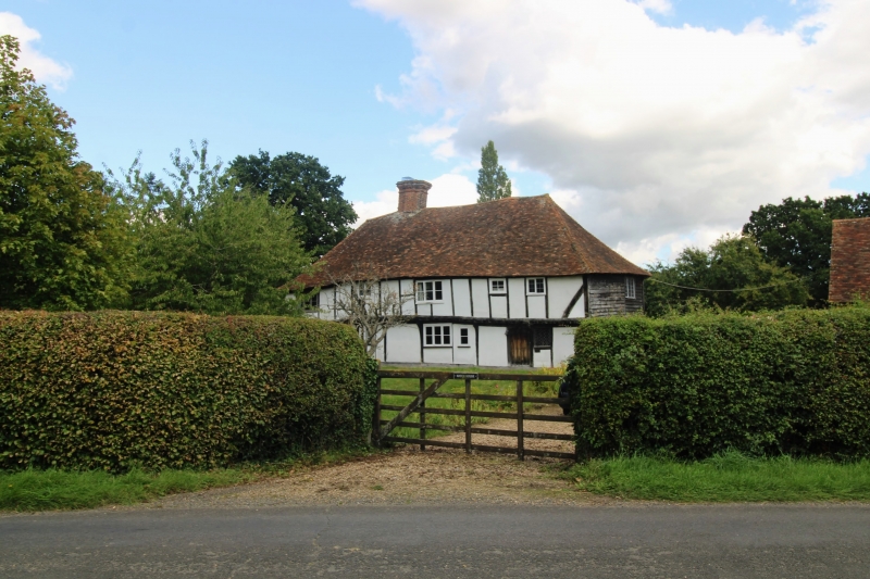
1. 5272 SMARDEN BELL ROAD Watch House TQ 84 SE 13/66 17.9.52 II 2. C16 or earlier timber-framed building with plaster infilling, the first floor oversailing on the protruding ends of the floor joists and brackets (each end now running downhill) and with curved braces. Hipped tiled roof. Sprocket eaves. Five casement windows.
Listing NGR: TQ8646243522
External links are from the relevant listing authority and, where applicable, Wikidata. Wikidata IDs may be related buildings as well as this specific building. If you want to add or update a link, you will need to do so by editing the Wikidata entry.


Other nearby listed buildings