Approximate Location Map
Large Map »
Latitude: 51.3568 / 51°21'24"N
Longitude: 1.0247 / 1°1'28"E
OS Eastings: 610689
OS Northings: 166317
OS Grid: TR106663
Mapcode National: GBR TX1.V70
Mapcode Global: VHKJR.Q525
Plus Code: 9F33924F+PV
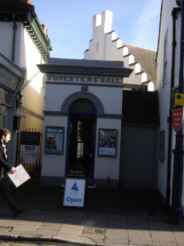
Entry Name: Foresters Hall
Listing Date: 20 May 1977
Grade: II
Source: Historic England
Source ID: 1106297
English Heritage Legacy ID: 170852
ID on this website: 101106297
Location: Whitstable, Canterbury, Kent, CT5
County: Kent
District: Canterbury
Electoral Ward/Division: Gorrell
Parish: Non Civil Parish
Built-Up Area: Whitstable
Traditional County: Kent
Lieutenancy Area (Ceremonial County): Kent
Tagged with: Building
1. OXFORD STREET
5273
(East Side)
Foresters Hall
TR 1066 SE 2/161
II GV
2.
Listed solely for its circa 1830 single storey entrance: semi-circular
headed door with moulded architrave and moulded cornice with parapet.
The hall itself is of later date and not of special interest.
Listing NGR: TR1068966317
External links are from the relevant listing authority and, where applicable, Wikidata. Wikidata IDs may be related buildings as well as this specific building. If you want to add or update a link, you will need to do so by editing the Wikidata entry.


Other nearby listed buildings
