Approximate Location Map
Large Map »
Latitude: 51.3588 / 51°21'31"N
Longitude: 1.0212 / 1°1'16"E
OS Eastings: 610438
OS Northings: 166520
OS Grid: TR104665
Mapcode National: GBR TX1.M0Z
Mapcode Global: VHKJR.N37Q
Plus Code: 9F33925C+GF
Entry Name: The Vines
Listing Date: 20 May 1977
Grade: II
Source: Historic England
Source ID: 1106354
English Heritage Legacy ID: 170837
ID on this website: 101106354
Location: Lower Island, Canterbury, Kent, CT5
County: Kent
District: Canterbury
Electoral Ward/Division: Gorrell
Parish: Non Civil Parish
Built-Up Area: Whitstable
Traditional County: Kent
Lieutenancy Area (Ceremonial County): Kent
Tagged with: Building
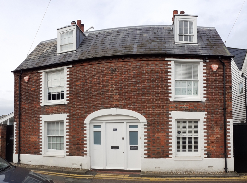
ISLAND HALL
1.
5275
(North-West Side)
No 48
(The Vines)
TR 16 NW 4/14
II
2.
Early C19. 2 storeys and attic. 2 window and extra window ground floor with a
pentice roof over it. 2 dormers. Red brick and grey headers, minted round the
windows to form dressing. Modillion eaves cornice. Slate roof. Glazing bars
intact. Doorway in wide 4 centred arch with keystones, door flanked by 2 narrow
lights.
Listing NGR: TR1043866520
External links are from the relevant listing authority and, where applicable, Wikidata. Wikidata IDs may be related buildings as well as this specific building. If you want to add or update a link, you will need to do so by editing the Wikidata entry.


Other nearby listed buildings
