Approximate Location Map
Large Map »
Latitude: 51.0225 / 51°1'20"N
Longitude: 0.7645 / 0°45'52"E
OS Eastings: 593976
OS Northings: 128428
OS Grid: TQ939284
Mapcode National: GBR RY3.VGG
Mapcode Global: FRA D6HD.TY9
Plus Code: 9F322QC7+XR
Entry Name: Oat Barn
Listing Date: 9 August 1979
Grade: II
Source: Historic England
Source ID: 1106382
English Heritage Legacy ID: 180441
ID on this website: 101106382
Location: Stone in Oxney, Ashford, Kent, TN30
County: Kent
District: Ashford
Civil Parish: Stone-cum-Ebony
Traditional County: Kent
Lieutenancy Area (Ceremonial County): Kent
Tagged with: Building
STONE-CUM-EBONY LOWER ROAD
1.
5272
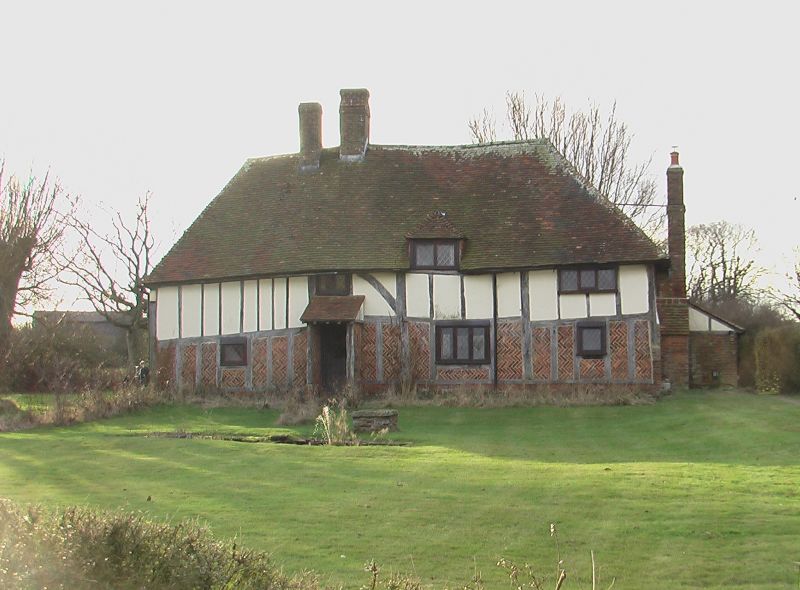
Oat Barn
TQ 92 NW 13/410
II
2.
Late mediaeval timber framed hall-house with hall of 2 bays. Modern brick
infilling on ground floor and plaster infilling above. Hipped tiled roof.
Two storeys. Three casement windows.
Listing NGR: TQ9397628428
External links are from the relevant listing authority and, where applicable, Wikidata. Wikidata IDs may be related buildings as well as this specific building. If you want to add or update a link, you will need to do so by editing the Wikidata entry.


Other nearby listed buildings
