Latitude: 51.6967 / 51°41'48"N
Longitude: -2.2171 / 2°13'1"W
OS Eastings: 385089
OS Northings: 199795
OS Grid: ST850997
Mapcode National: GBR 1N4.J8R
Mapcode Global: VH954.JM75
Plus Code: 9C3VMQWM+M4
Entry Name: Hencotes
Listing Date: 17 July 1980
Grade: II
Source: Historic England
Source ID: 1107174
English Heritage Legacy ID: 354662
ID on this website: 101107174
Location: Egypt, Stroud, Gloucestershire, GL6
County: Gloucestershire
District: Stroud
Civil Parish: Nailsworth
Built-Up Area: Nailsworth
Traditional County: Gloucestershire
Lieutenancy Area (Ceremonial County): Gloucestershire
Church of England Parish: Nailsworth St George
Church of England Diocese: Gloucester
Tagged with: Building
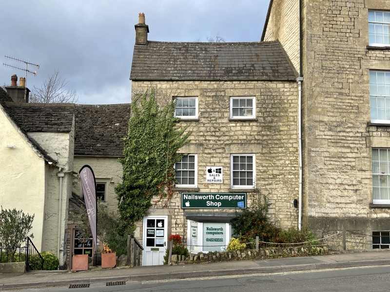
GEORGE STREET
1.
5227
Hencotes
ST 8599 6/9A
II GV
2.
Early-mid C19. Three storey lower extension to Glenholm. Rubble with
slate roof. Two windows, glazing bar sashes, one bay on ground floor.
Door to left. Included for group value.
Listing NGR: ST8508999795
External links are from the relevant listing authority and, where applicable, Wikidata. Wikidata IDs may be related buildings as well as this specific building. If you want to add or update a link, you will need to do so by editing the Wikidata entry.


Other nearby listed buildings