Latitude: 51.1517 / 51°9'6"N
Longitude: 0.7171 / 0°43'1"E
OS Eastings: 590122
OS Northings: 142675
OS Grid: TQ901426
Mapcode National: GBR QV5.N42
Mapcode Global: VHKKK.C9ZX
Plus Code: 9F325P28+MR
Entry Name: Dawkins
Listing Date: 14 February 1967
Grade: II
Source: Historic England
Source ID: 1107941
English Heritage Legacy ID: 181228
ID on this website: 101107941
Location: Maltman's Hill, Ashford, Kent, TN27
County: Kent
District: Ashford
Civil Parish: Smarden
Traditional County: Kent
Lieutenancy Area (Ceremonial County): Kent
Tagged with: Building
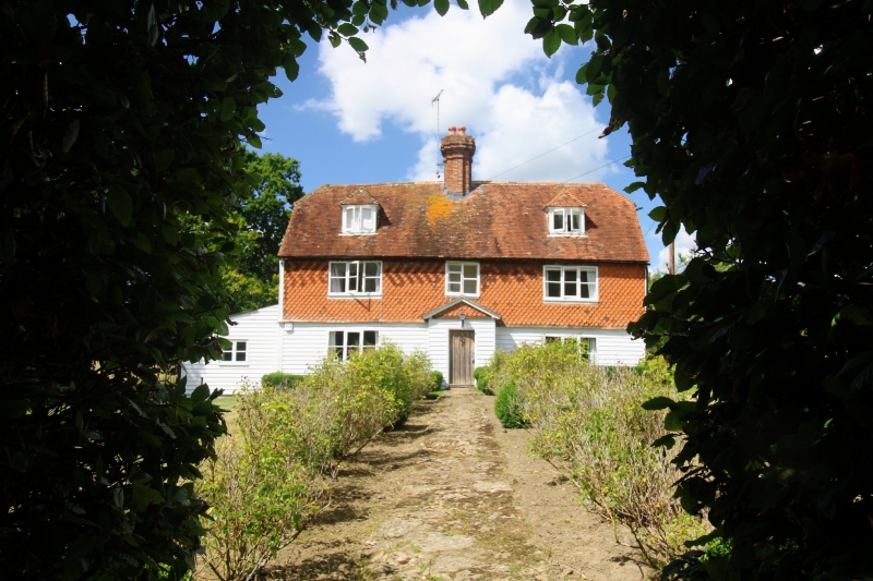
1.
5272 SMARDEN ROMDEN ROAD
Dawkins
TQ 94 SW 14/82 14.2.67.
Il
2.
C17 or earlier. Two storeys and attics. Ground floor faced with weatherboarding,
above tile-hung with the hint of an overhang between. Half-hipped tiled roof
with 2 hipped dormers. Three casement windows. Modern porch.
Listing NGR: TQ9012242675
External links are from the relevant listing authority and, where applicable, Wikidata. Wikidata IDs may be related buildings as well as this specific building. If you want to add or update a link, you will need to do so by editing the Wikidata entry.


Other nearby listed buildings