Latitude: 50.3844 / 50°23'3"N
Longitude: -3.6031 / 3°36'11"W
OS Eastings: 286124
OS Northings: 55062
OS Grid: SX861550
Mapcode National: GBR QR.H9XV
Mapcode Global: FRA 38B1.43C
Plus Code: 9C2R99MW+QQ
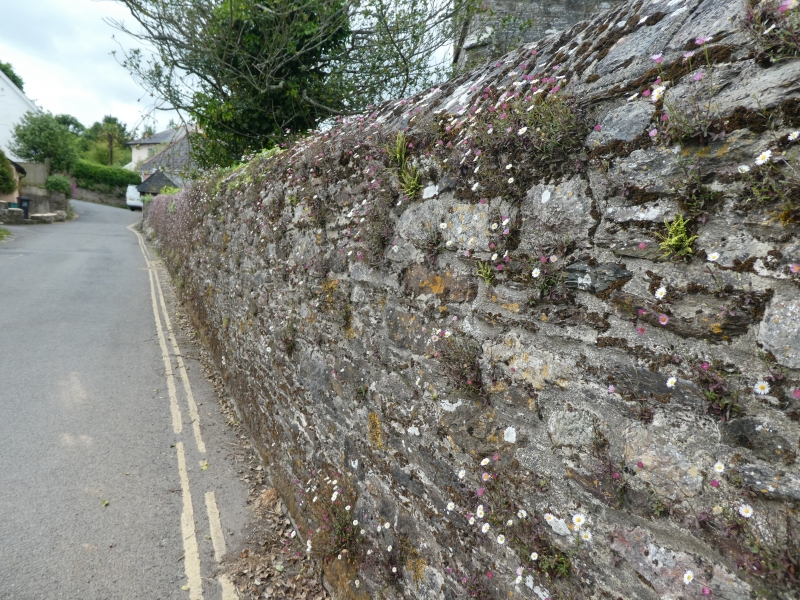
Entry Name: Wall on South Side of Churchyard of Church of St George
Listing Date: 26 April 1993
Grade: II
Source: Historic England
Source ID: 1108271
English Heritage Legacy ID: 101228
ID on this website: 101108271
Location: St George's Church, Dittisham, South Hams, Devon, TQ6
County: Devon
District: South Hams
Civil Parish: Dittisham
Built-Up Area: Dittisham
Traditional County: Devon
Lieutenancy Area (Ceremonial County): Devon
Church of England Parish: Dittisham St George
Church of England Diocese: Exeter
Tagged with: Wall
DITTISHAM SX8655 RIVERSIDE ROAD 16/316 Wall on S side of churchyard of Church of St George
GV II
Churchyard boundary wall. Probably C19. Local stone rubble, predominately local limestone and slate, the lower courses have more slate and above at the west end there is more limestone. Therefore it might have been raised and partly rebuilt in the C19. Local limestone rubble saddle=back coping. Pair of square stone rubble gate-piers near east end, rebated for a gate; the gate is C20. At the east end there is a large projecting circular pier against the outside of the wall. This is probably one of a pair of gate- piers to Dittisham Court (gv), the other having been demolished.
Listing NGR: SX8612555061
External links are from the relevant listing authority and, where applicable, Wikidata. Wikidata IDs may be related buildings as well as this specific building. If you want to add or update a link, you will need to do so by editing the Wikidata entry.


Other nearby listed buildings