Latitude: 50.3481 / 50°20'53"N
Longitude: -3.5725 / 3°34'21"W
OS Eastings: 288213
OS Northings: 50983
OS Grid: SX882509
Mapcode National: GBR QS.RKRZ
Mapcode Global: FRA 38D3.XP2
Plus Code: 9C2R8CXG+7X
Entry Name: Sarah Roope's Almshouses
Listing Date: 21 May 1985
Grade: II
Source: Historic England
Source ID: 1108542
English Heritage Legacy ID: 100565
ID on this website: 101108542
Location: Kingswear, South Hams, Devon, TQ6
County: Devon
District: South Hams
Civil Parish: Kingswear
Built-Up Area: Kingswear
Traditional County: Devon
Lieutenancy Area (Ceremonial County): Devon
Church of England Parish: Kingswear
Church of England Diocese: Exeter
Tagged with: Almshouse
SX 8850 KINGSWEAR BEACON ROAD
16/78 Sarah Roope's Almshouses -
- II
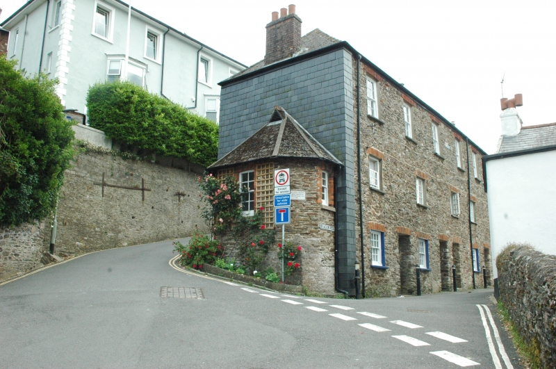
Five almshouses and a Sunday School room. Dated 1840 (tablet centre second floor front). Restored circa 1951. Slate rubble with red brick window arches. Scantle slate hung south end. Asbestos slate hipped roof. Three storeys: two bays. Small sashes with glazing bars, some replaced with casements with glazing bars in the original openings. All openings have red brick flat arches including the three plain recessed archways with C20 glazed bars. Slate window cills. Red brick chimney stack at ends and one at centre rear. Later C19 polygonal porch on north end with plaque inscribed 'Trust Houses renovated by public subscription Festival of Britain year 1951'. The almshouses were given in trust by Miss Sarah Roope.
Listing NGR: SX8821350983
External links are from the relevant listing authority and, where applicable, Wikidata. Wikidata IDs may be related buildings as well as this specific building. If you want to add or update a link, you will need to do so by editing the Wikidata entry.


Other nearby listed buildings