Approximate Location Map
Large Map »
Latitude: 50.3415 / 50°20'29"N
Longitude: -4.0099 / 4°0'35"W
OS Eastings: 257079
OS Northings: 50991
OS Grid: SX570509
Mapcode National: GBR Q3.8V50
Mapcode Global: FRA 28H4.7NS
Plus Code: 9C2Q8XRR+H3
Entry Name: Puslinch Bridge
Listing Date: 23 April 1952
Grade: II
Source: Historic England
Source ID: 1108566
English Heritage Legacy ID: 100529
ID on this website: 101108566
Location: South Hams, Devon, PL8
County: Devon
District: South Hams
Civil Parish: Yealmpton
Traditional County: Devon
Lieutenancy Area (Ceremonial County): Devon
Tagged with: Bridge
SX 55 SE & SX5751 YEALMPTON
4/253 and 11/253
23/4/52 Puslinch Bridge
(Formerly listed Under
Newton & Noss)
II
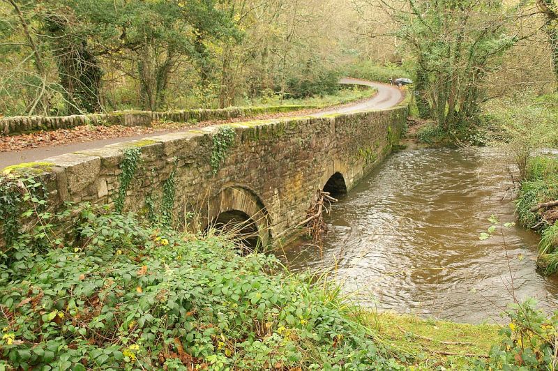
Road bridge over River Yealm at the head of the creek. Circa C17. Stone rubble.
Two spans over main stream and another flood arch at north end connected by
causeway. Obtusely pointed arched with recessed arch rings. Between the two south
arches on the dowstream side a cutwater with refuge above. Very low parapets.
Reference. C. Henderson and E. Jervoise, Old Devon Bridges, page 22.
Listing NGR: SX5707950991
External links are from the relevant listing authority and, where applicable, Wikidata. Wikidata IDs may be related buildings as well as this specific building. If you want to add or update a link, you will need to do so by editing the Wikidata entry.


Other nearby listed buildings
