Latitude: 53.2231 / 53°13'23"N
Longitude: -1.7037 / 1°42'13"W
OS Eastings: 419881
OS Northings: 369600
OS Grid: SK198696
Mapcode National: GBR 467.VFV
Mapcode Global: WHCD6.S7XY
Plus Code: 9C5W67FW+6G
Entry Name: Mill Bridge
Listing Date: 12 July 1967
Grade: II
Source: Historic England
Source ID: 1109261
English Heritage Legacy ID: 80484
ID on this website: 101109261
Location: Ashford in the Water, Derbyshire Dales, Derbyshire, DE45
County: Derbyshire
District: Derbyshire Dales
Civil Parish: Ashford in the Water
Traditional County: Derbyshire
Lieutenancy Area (Ceremonial County): Derbyshire
Church of England Parish: Ashford-in-the-Water Holy Trinity
Church of England Diocese: Derby
SK 19 69 PARISH OF ASHFORD IN THE WATER MILL LANE 11/54 12.7.1967 Mill Bridge GV II
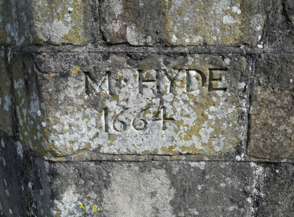
Bridge. 1664, with later restoration. Ashlar gritstone and limestone rubble. Three segmental arches, with two ribs to west side, limestone rubble to east. Two cutwaters between, to either side, rising to form V-shaped recesses in parapet wall over. Stringcourse over arches, parapet wall slightly recessed. Chamfered copings on river faces, flush inner walls. At each end , walls splay outwards. To east side,on road side,stone inscribed 'M Hyde 1664'.
Listing NGR: SK1988169600


Other nearby listed buildings