Latitude: 53.0678 / 53°4'3"N
Longitude: -1.7405 / 1°44'25"W
OS Eastings: 417485
OS Northings: 352310
OS Grid: SK174523
Mapcode National: GBR 483.QRK
Mapcode Global: WHCDZ.75F0
Plus Code: 9C5W3795+3R
Entry Name: Stableblock to Tissington Hall
Listing Date: 13 September 1967
Grade: II
Source: Historic England
Source ID: 1109275
English Heritage Legacy ID: 80415
ID on this website: 101109275
Location: Tissington, Derbyshire Dales, Derbyshire, DE6
County: Derbyshire
District: Derbyshire Dales
Civil Parish: Tissington and Lea Hall
Traditional County: Derbyshire
Lieutenancy Area (Ceremonial County): Derbyshire
Church of England Parish: Tissington St Mary
Church of England Diocese: Derby
SK 17 52 PARISH OF TISSINGTON RAKES LANE 11/145 (West Side) 13.9.1967 Stableblock to Tissington Hall
GV II
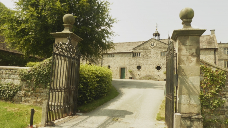
Stables. Early C17 and C18. Rubble limestone with sandstone dressings. Stone slate roof with stone coped gables. Stone gable end stack and bellcote with open sides. Two storeys. Gabled cross-wing at the south end. West elevation - Ground floor with four blocked doorways with stone surrounds, segmental arched heads and horizontal dripmoulds. Four 3-light recessed chamfer mullion windows above. East elevation - with two doorways with moulded stone surrounds and four occuli windows with moulded stone surrounds with keystones. In the rythm of window to door, ABAABA and to the gabled bay a large round-arched carriage arch with stone surround with projector imposts and keystone. Five 4-light recessed chamfer mullion windows above, the centre pair beneath a pedimented gable with a clock in moulded stone surround.
Listing NGR: SK1748552310
External links are from the relevant listing authority and, where applicable, Wikidata. Wikidata IDs may be related buildings as well as this specific building. If you want to add or update a link, you will need to do so by editing the Wikidata entry.


Other nearby listed buildings