Latitude: 53.2867 / 53°17'12"N
Longitude: -1.6778 / 1°40'39"W
OS Eastings: 421578
OS Northings: 376683
OS Grid: SK215766
Mapcode National: GBR JZQF.KJ
Mapcode Global: WHCCV.6N96
Plus Code: 9C5W78PC+MV
Entry Name: Wall and Water Troughs to South East of Edge Moor
Listing Date: 12 October 1984
Grade: II
Source: Historic England
Source ID: 1110026
English Heritage Legacy ID: 80660
ID on this website: 101110026
Location: Eyam, Derbyshire Dales, Derbyshire, S32
County: Derbyshire
District: Derbyshire Dales
Civil Parish: Eyam
Built-Up Area: Eyam
Traditional County: Derbyshire
Lieutenancy Area (Ceremonial County): Derbyshire
Church of England Parish: Eyam St Lawrence
Church of England Diocese: Derby
Tagged with: Wall
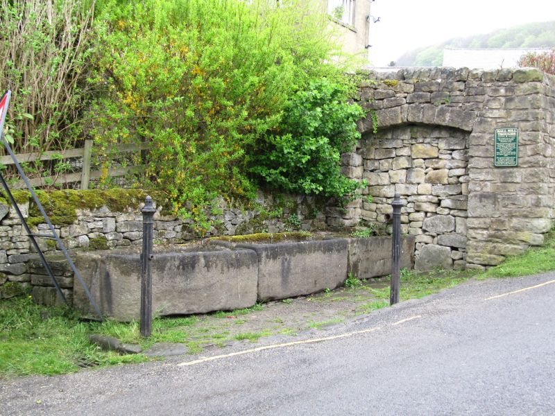
SK 21 76 PARISH OF EYAM HAWKHILL ROAD
6/52 (West Side)
Wall and Water Troughs to SE
of Edge Moor
GV II
Wall and water troughs. C17, restored C20. Gritstone with gritstone rubble.
High rubble retaining wall with three large stone troughs to east. Part of
early public drinking water supply.
Listing NGR: SK2157876683
External links are from the relevant listing authority and, where applicable, Wikidata. Wikidata IDs may be related buildings as well as this specific building. If you want to add or update a link, you will need to do so by editing the Wikidata entry.


Other nearby listed buildings