Approximate Location Map
Large Map »
Latitude: 50.7174 / 50°43'2"N
Longitude: -2.4395 / 2°26'22"W
OS Eastings: 369067
OS Northings: 90960
OS Grid: SY690909
Mapcode National: GBR PY.R79K
Mapcode Global: FRA 57S5.TP6
Plus Code: 9C2VPH86+X5
Entry Name: 8, Glyde Path Road
Listing Date: 8 May 1975
Grade: II
Source: Historic England
Source ID: 1110609
English Heritage Legacy ID: 104282
ID on this website: 101110609
Location: Dorchester, Dorset, DT1
County: Dorset
Civil Parish: Dorchester
Built-Up Area: Dorchester
Traditional County: Dorset
Lieutenancy Area (Ceremonial County): Dorset
Church of England Parish: Dorchester and West Stafford
Church of England Diocese: Salisbury
Tagged with: Building
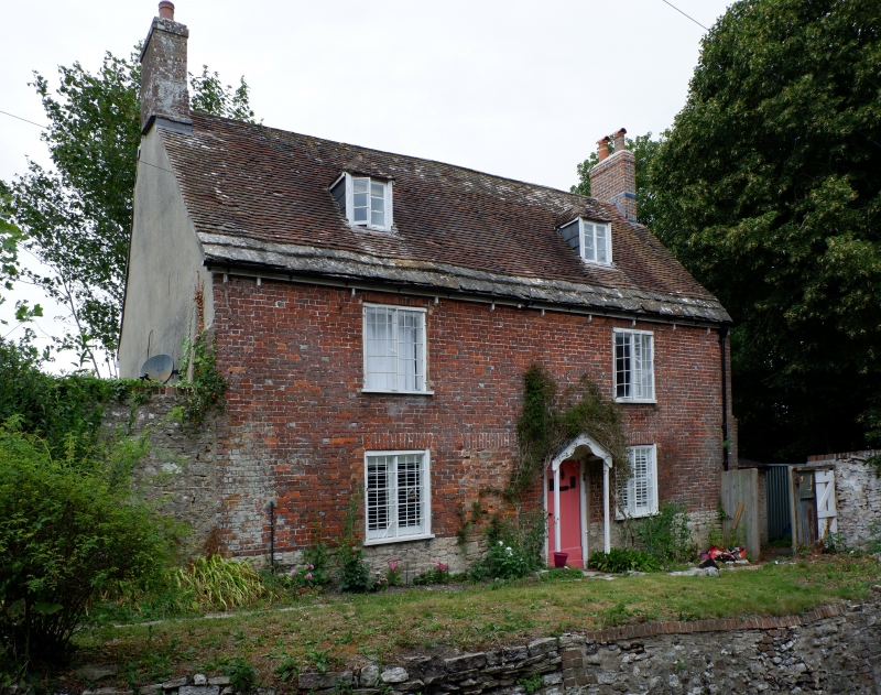
GLYDE PATH ROAD
1.
5191
(West Side)
No 8
SY 6990 7/8
II
2.
Terra-cotta tablet on front has date "1713". Double-fronted brick cottage,
2 storeys and attic. Gable-ends. Plaintile roof with stone slates at eaves.
2 hipped dormers. Casement windows with small panes. Doorway has gabled hood,
probably later. House above road level. Ledged door.
Listing NGR: SY6906790960
External links are from the relevant listing authority and, where applicable, Wikidata. Wikidata IDs may be related buildings as well as this specific building. If you want to add or update a link, you will need to do so by editing the Wikidata entry.


Other nearby listed buildings
