Latitude: 50.7116 / 50°42'41"N
Longitude: -2.4455 / 2°26'43"W
OS Eastings: 368638
OS Northings: 90309
OS Grid: SY686903
Mapcode National: GBR PY.5RNK
Mapcode Global: FRA 57R6.C30
Plus Code: 9C2VPH63+JQ
Entry Name: Damers Hospital
Listing Date: 8 May 1975
Grade: II
Source: Historic England
Source ID: 1110636
English Heritage Legacy ID: 104246
ID on this website: 101110636
Location: Dorchester, Dorset, DT1
County: Dorset
Civil Parish: Dorchester
Built-Up Area: Dorchester
Traditional County: Dorset
Lieutenancy Area (Ceremonial County): Dorset
Church of England Parish: Dorchester and West Stafford
Church of England Diocese: Salisbury
Tagged with: Building
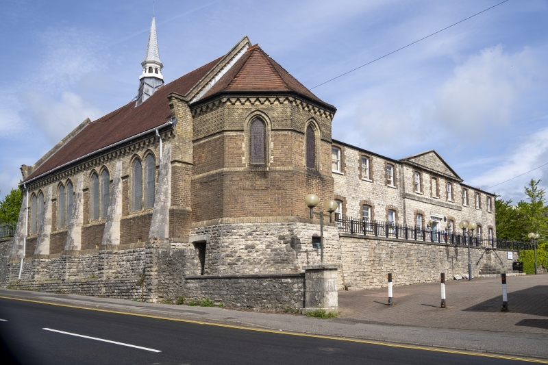
DAMERS ROAD 1. 5191 Damers Hospital SY 6890 7/162 II 2. Included for east front and chapel alone. 1836. Former Poor Law Institution. Architect George Wilkinson. Portland or Ridgeway hammer dressed stone. Red brick dressings. Hipped slate roof. 2 storeys. 9 ranges of sashes, those on ground floor with glazing bars. Central 3 bays break forward and have plain band at 1st floor, moulded eaves cornice and pediment. Doorway with overscaled modillion cornice. Chapel of circa 1870. Brown brick, with moulded diaper work around upper part of apse exterior. Moulded yellow brick cornice. Pitched tile roof. Open fleche with spirelet at west end. Polygonal apse. Paired lancets separated by ashlar buttresses.
Listing NGR: SY6863890309
External links are from the relevant listing authority and, where applicable, Wikidata. Wikidata IDs may be related buildings as well as this specific building. If you want to add or update a link, you will need to do so by editing the Wikidata entry.


Other nearby listed buildings