Latitude: 51.8182 / 51°49'5"N
Longitude: 1.186 / 1°11'9"E
OS Eastings: 619681
OS Northings: 218088
OS Grid: TM196180
Mapcode National: GBR VRZ.STL
Mapcode Global: VHLCZ.HKVJ
Plus Code: 9F33R59P+79
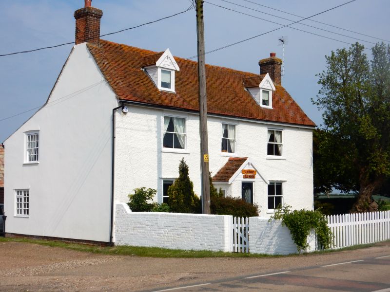
Entry Name: Sladbury's Old House
Listing Date: 4 July 1986
Grade: II
Source: Historic England
Source ID: 1111521
English Heritage Legacy ID: 119872
ID on this website: 101111521
Location: Tendring, Essex, CO15
County: Essex
District: Tendring
Electoral Ward/Division: Burrsville
Parish: Non Civil Parish
Traditional County: Essex
Lieutenancy Area (Ceremonial County): Essex
Church of England Parish: Holland-on-Sea St Bartholomew
Church of England Diocese: Chelmsford
Tagged with: House
CLACTON-ON-SEA SLADBURY'S LANE
TM 11 NE
7/12 Sladbury's Old House
GV II
House. C18. Timber framed, pebble dash plastered. Red plain tiled roof.
Right and left red brick chimney stacks. 2 storeys and attics. 2 gabled
dormers. 3 window range of vertically sliding sashes with glazing bars.
Central enclosed gabled porch. 6 panelled door.
Listing NGR: TM1968118088
External links are from the relevant listing authority and, where applicable, Wikidata. Wikidata IDs may be related buildings as well as this specific building. If you want to add or update a link, you will need to do so by editing the Wikidata entry.


Other nearby listed buildings