Latitude: 51.7843 / 51°47'3"N
Longitude: 0.1331 / 0°7'59"E
OS Eastings: 547232
OS Northings: 211667
OS Grid: TL472116
Mapcode National: GBR LDJ.4GR
Mapcode Global: VHHM7.8F60
Plus Code: 9F32Q4MM+P6
Entry Name: Barclays Bank
Listing Date: 19 June 1981
Grade: II
Source: Historic England
Source ID: 1111673
English Heritage Legacy ID: 119574
ID on this website: 101111673
Location: Old Harlow, Harlow, Essex, CM17
County: Essex
District: Harlow
Electoral Ward/Division: Old Harlow
Parish: Non Civil Parish
Built-Up Area: Harlow
Traditional County: Essex
Lieutenancy Area (Ceremonial County): Essex
Church of England Parish: Harlow St Mary and St Hugh with St John the Baptist
Church of England Diocese: Chelmsford
Tagged with: Bank building
1. 5216 STATION ROAD Barclays Bank TL 41 NW 5/1
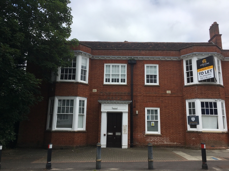
II GV 2. Early C18 house. Two storeys, of red brick in Flemish bond, with a parapet coped in stone. Roof ridged, gabled and peg-tiled with south chimney stack having 3 octagonal shafts - all red brick. Eaves band of moulded timber with mutules and leaded top. Two semi-hexagonal bay windows, left and right with 3 pairs of small paned sashes each on first storey, their ground storey windows modernised for bank usage. Three-part sash and a pair of sashes, all small-paned on first storey betwixt bay windows. Matching sash on ground storey with door in a square porch of red brick with flat top and fluted pilasters each side, top oversails on mutules.
Listing NGR: TL4723211667
External links are from the relevant listing authority and, where applicable, Wikidata. Wikidata IDs may be related buildings as well as this specific building. If you want to add or update a link, you will need to do so by editing the Wikidata entry.


Other nearby listed buildings