Latitude: 51.7818 / 51°46'54"N
Longitude: 0.1489 / 0°8'55"E
OS Eastings: 548330
OS Northings: 211426
OS Grid: TL483114
Mapcode National: GBR LDK.8GJ
Mapcode Global: VHHM7.JGKW
Plus Code: 9F32Q4JX+PH
Entry Name: Number 28, Number 30 (Disty's) and Number 32
Listing Date: 19 June 1981
Last Amended: 17 June 1982
Grade: II
Source: Historic England
Source ID: 1111701
English Heritage Legacy ID: 119447
ID on this website: 101111701
Location: Churchgate Street, Harlow, Essex, CM17
County: Essex
District: Harlow
Electoral Ward/Division: Old Harlow
Parish: Non Civil Parish
Built-Up Area: Harlow
Traditional County: Essex
Lieutenancy Area (Ceremonial County): Essex
Church of England Parish: Harlow St Mary and St Hugh with St John the Baptist
Church of England Diocese: Chelmsford
Tagged with: Building
1.
5216
TL 4811 SW
9/6
CHURCHGATE STREET
(west side)
No 28, No 30 (Disty's) and No 32
II
GV
2.
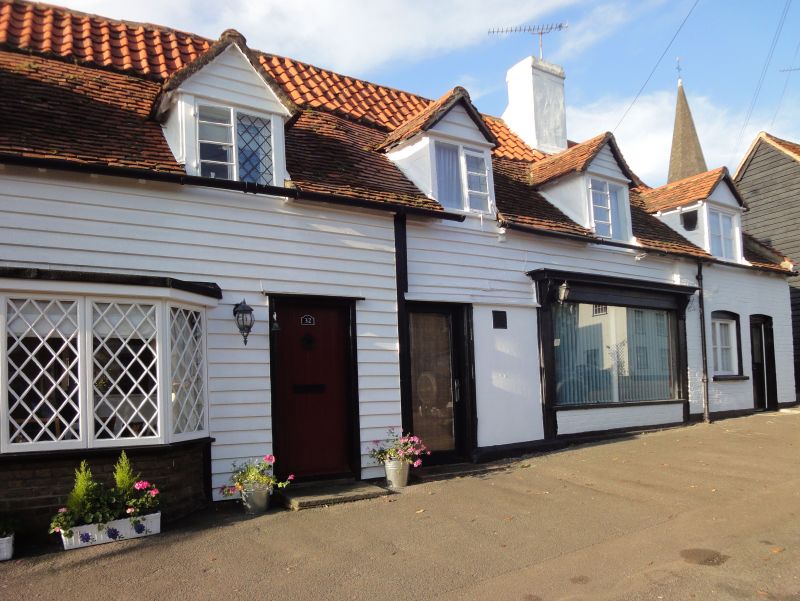
Circa 1700 house. Long range of one storey with attics; roof of mixed
peg and pantiles, fly-hipped. One red brick chimney stack close to north
end. Five gabled dormers, with small-paned sashes. Wall white weatherboarded
where surviving, 2 modern doors and several modern windows of various types.
C19 shop window unit under second dormer from north. Inside: the timber
frame is visible in places, floors with heavy, deep sectioned joists between
binders.
Listing NGR: TL4833011426
External links are from the relevant listing authority and, where applicable, Wikidata. Wikidata IDs may be related buildings as well as this specific building. If you want to add or update a link, you will need to do so by editing the Wikidata entry.


Other nearby listed buildings