Approximate Location Map
Large Map »
Latitude: 53.0868 / 53°5'12"N
Longitude: -1.6254 / 1°37'31"W
OS Eastings: 425185
OS Northings: 354468
OS Grid: SK251544
Mapcode National: GBR 59D.HVT
Mapcode Global: WHCDV.0N8X
Plus Code: 9C5W39PF+PR
Entry Name: Windmill
Listing Date: 11 October 1983
Grade: II
Source: Historic England
Source ID: 1111797
English Heritage Legacy ID: 80052
ID on this website: 101111797
Location: Derbyshire Dales, Derbyshire, DE4
County: Derbyshire
District: Derbyshire Dales
Civil Parish: Hopton
Built-Up Area: Middleton
Traditional County: Derbyshire
Lieutenancy Area (Ceremonial County): Derbyshire
Church of England Parish: Wirksworth St Mary
Church of England Diocese: Derby
SK 25 SE HOPTON AND GRIFFE GRANGE BRASSINGTON ROAD
4/100 (South Side)
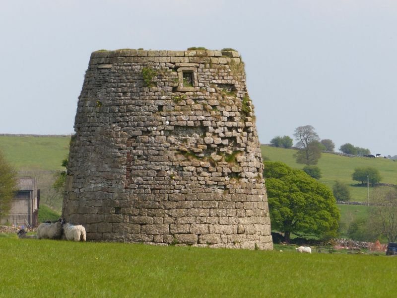
Windmill
II
Base of windmill. C18. Coursed limestone rubble with gritstone dressings.
Circular tapering tower without cap or machinery. Blocked doorcase with
massive lintel to north. Various square window openings, with flush dressings.
Gritstone capping band at top.
Listing NGR: SK2518554468
External links are from the relevant listing authority and, where applicable, Wikidata. Wikidata IDs may be related buildings as well as this specific building. If you want to add or update a link, you will need to do so by editing the Wikidata entry.


Other nearby listed buildings
