Latitude: 51.1858 / 51°11'8"N
Longitude: 1.1442 / 1°8'39"E
OS Eastings: 619824
OS Northings: 147650
OS Grid: TR198476
Mapcode National: GBR TZB.N3B
Mapcode Global: VHLH1.SG8B
Plus Code: 9F3354PV+8M
Entry Name: Breach Farmhouse
Listing Date: 30 January 1967
Grade: II
Source: Historic England
Source ID: 1111914
English Heritage Legacy ID: 170934
ID on this website: 101111914
Location: Breach, Canterbury, Kent, CT4
County: Kent
District: Canterbury
Civil Parish: Barham
Traditional County: Kent
Lieutenancy Area (Ceremonial County): Kent
Tagged with: Farmhouse
1. 5273 BARHAM SOUTH BARHAM ROAD (south-east side)
Breach Farmhouse TR 14 NE 17/60 30.1.67
II GV
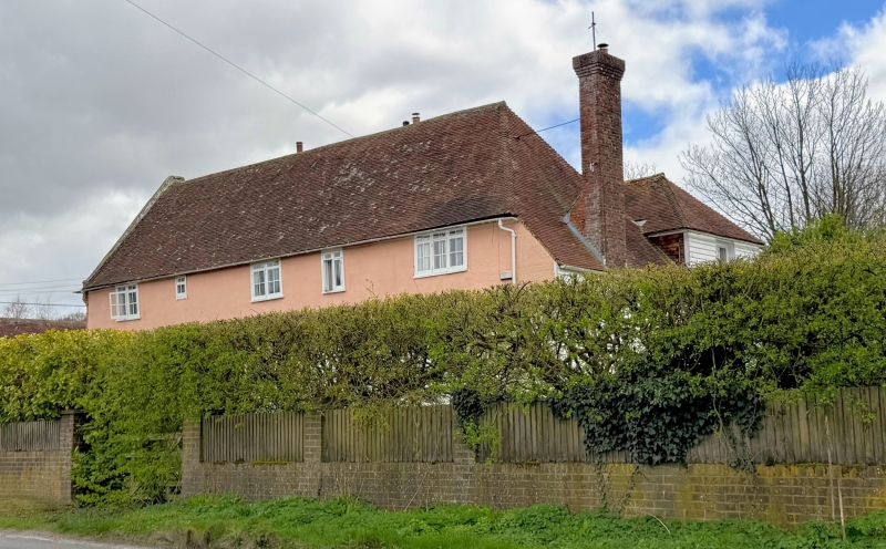
2. Probably C16 timber-framed building with plastered front, the first floor oversailing on bressumer and brackets, the south end of the ground floor underbuilt in painted brick and with a brick buttress at the north-east corner. Tiled roof. The north gable end and wall are of painted red brick. Two small brick bays built out on ground floor. C19 porch of flints and brick with shaped gable. Blocked mullion windows to the gable end. Chimneys paired and diagonal-set, with tumbled brickwork.
Listing NGR: TR1982447650
External links are from the relevant listing authority and, where applicable, Wikidata. Wikidata IDs may be related buildings as well as this specific building. If you want to add or update a link, you will need to do so by editing the Wikidata entry.


Other nearby listed buildings