Approximate Location Map
Large Map »
Latitude: 50.9116 / 50°54'41"N
Longitude: -1.3024 / 1°18'8"W
OS Eastings: 449140
OS Northings: 112686
OS Grid: SU491126
Mapcode National: GBR 87T.MKJ
Mapcode Global: FRA 865P.LFJ
Plus Code: 9C2WWM6X+J2
Entry Name: 16, Freegrounds Road
Listing Date: 14 February 1983
Grade: II
Source: Historic England
Source ID: 1111929
English Heritage Legacy ID: 355000
ID on this website: 101111929
Location: Hedge End, Eastleigh, Hampshire, SO30
County: Hampshire
District: Eastleigh
Civil Parish: Hedge End
Built-Up Area: Hedge End
Traditional County: Hampshire
Lieutenancy Area (Ceremonial County): Hampshire
Church of England Parish: Hedge End St John the Evangelist
Church of England Diocese: Winchester
Tagged with: Building Thatched cottage
1.
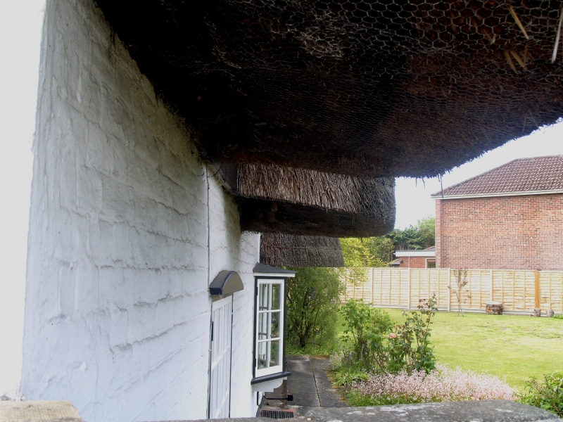
5230 HEDGE END FREEGROUNDS ROAD
No 16
SU 41 SE 6/149
II
2.
Early C19. Two storeyed cottage, with upper windows having cills at eaves level.
Thatched roof, hipped at west end with a lower section at east. Painted brickwork,
some cambered ground floor openings. Casements.
Listing NGR: SU4913612683
External links are from the relevant listing authority and, where applicable, Wikidata. Wikidata IDs may be related buildings as well as this specific building. If you want to add or update a link, you will need to do so by editing the Wikidata entry.


Other nearby listed buildings
