Approximate Location Map
Large Map »
Latitude: 51.9155 / 51°54'55"N
Longitude: 0.3253 / 0°19'31"E
OS Eastings: 560025
OS Northings: 226663
OS Grid: TL600266
Mapcode National: GBR NFP.YWM
Mapcode Global: VHHLR.L3BX
Plus Code: 9F32W88G+64
Entry Name: Ruins of Tilty Abbey of St Mary
Listing Date: 7 February 1952
Grade: II
Source: Historic England
Source ID: 1112183
English Heritage Legacy ID: 122125
ID on this website: 101112183
Location: Tilty, Uttlesford, Essex, CM6
County: Essex
District: Uttlesford
Civil Parish: Tilty
Traditional County: Essex
Lieutenancy Area (Ceremonial County): Essex
Church of England Parish: Broxted with Chickney and Tilty and Great and Little Easton
Church of England Diocese: Chelmsford
TILTY CHURCH LANE
1.
5222
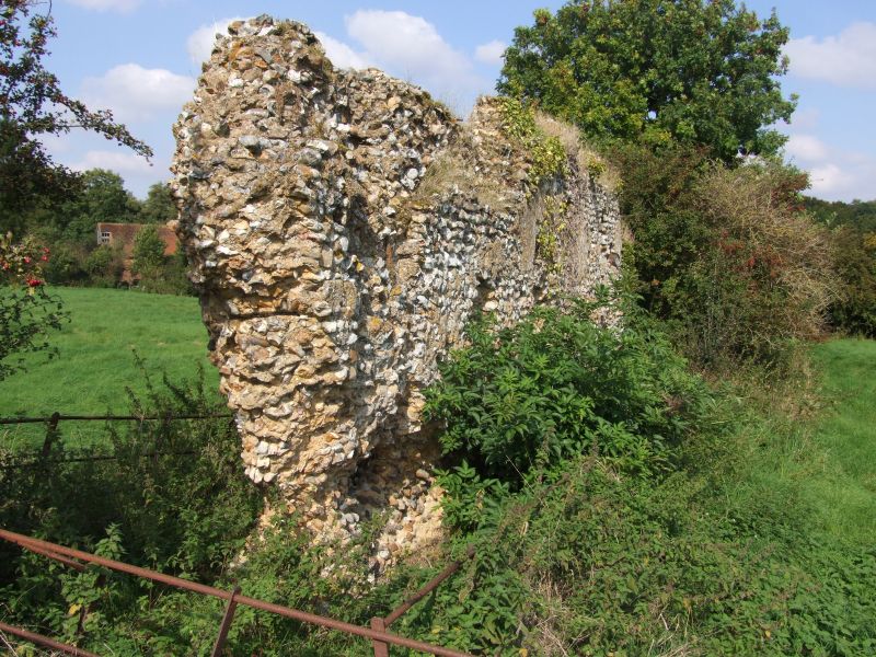
Ruins of Tilty Abbey
of St Mary
TL 62 NW 5/2 7.2.52
II
Cistercian foundation of 1153 by Maurice Fitz Geoffrey and Robert de Feneus.
Present remains are fragmentary pieces of flint rubble walling, probably west
range of cloister. (RCHM2) AM.
Listing NGR: TL6002526663
External links are from the relevant listing authority and, where applicable, Wikidata. Wikidata IDs may be related buildings as well as this specific building. If you want to add or update a link, you will need to do so by editing the Wikidata entry.


Other nearby listed buildings
