Approximate Location Map
Large Map »
Latitude: 51.5571 / 51°33'25"N
Longitude: -0.1768 / 0°10'36"W
OS Eastings: 526489
OS Northings: 185820
OS Grid: TQ264858
Mapcode National: GBR D0.G4C
Mapcode Global: VHGQR.W4D5
Plus Code: 9C3XHR4F+R7
Entry Name: Railings to Raised Pavement on North Side
Listing Date: 14 May 1974
Grade: II
Source: Historic England
Source ID: 1113008
English Heritage Legacy ID: 477334
ID on this website: 101113008
Location: Hampstead, Camden, London, NW3
County: London
District: Camden
Electoral Ward/Division: Hampstead Town
Parish: Non Civil Parish
Built-Up Area: Camden
Traditional County: Middlesex
Lieutenancy Area (Ceremonial County): Greater London
Church of England Parish: Christ Church Hampstead
Church of England Diocese: London
Tagged with: Guard rail
CAMDEN
TQ2685NW FLASK WALK
798-1/26/476 (North side)
14/05/74 Railings to raised pavement on north
side
GV II
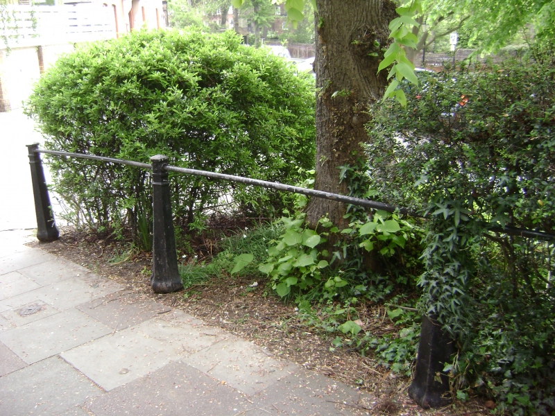
Railings to raised pavement on north side of street. Late C19.
Baluster type standards with plain rail.
Listing NGR: TQ2648785816
External links are from the relevant listing authority and, where applicable, Wikidata. Wikidata IDs may be related buildings as well as this specific building. If you want to add or update a link, you will need to do so by editing the Wikidata entry.


Other nearby listed buildings
